
File:Dottie 1976 rainfall.png

Size of this preview: 468 × 599 pixels. Other resolutions: 187 × 240 pixels | 375 × 480 pixels | 686 × 878 pixels.
Original file (686 × 878 pixels, file size: 19 KB, MIME type: image/png)
| This is a file from the Wikimedia Commons. Information from its description page there is shown below. Commons is a freely licensed media file repository. You can help. |
Summary
| Description |
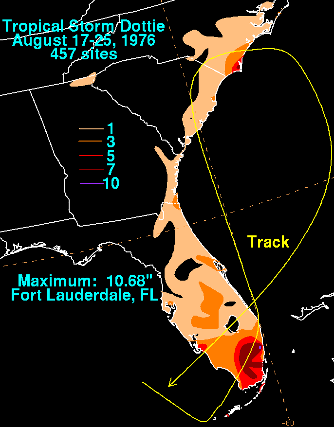
English: Storm total rainfall map of Tropical Storm Dottie during August 1976. |
|||
| Date | ||||
| Source | WPC tropical cyclone rainfall data | |||
| Author | David Roth, Weather Prediction Center, Camp Springs, Maryland | |||
| Permission (Reusing this file) |
|
Original upload log
| Date/Time | Dimensions | User | Comment |
|---|---|---|---|
| 14 July 2009, 03:59:11 | 686 × 878 (20883 bytes) | Cyclonebiskit (talk · contribs) | {{Information |Description=The initial low which evolved into Dottie formed 150 miles northwest of Key West due to a strong upper trough which had moved southward through the eastern Gulf of Mexico. By the morning of the 18th, a definite center had forme |
File history
Click on a date/time to view the file as it appeared at that time.
| Date/Time | Thumbnail | Dimensions | User | Comment | |
|---|---|---|---|---|---|
| current | 07:50, 5 January 2015 | | 686 × 878 (19 KB) | GifTagger | Bot: Converting file to superior PNG file. (Source: Dottie_1976_rainfall.gif). This GIF was problematic due to non-greyscale color table. |
File usage
The following pages on the English Wikipedia use this file (pages on other projects are not listed):