
File:Diu map 1886.jpg

Size of this preview: 766 × 599 pixels. Other resolutions: 307 × 240 pixels | 614 × 480 pixels | 982 × 768 pixels | 1,280 × 1,001 pixels | 2,040 × 1,596 pixels.
Original file (2,040 × 1,596 pixels, file size: 4.46 MB, MIME type: image/jpeg)
| This is a file from the Wikimedia Commons. Information from its description page there is shown below. Commons is a freely licensed media file repository. You can help. |
| Description |
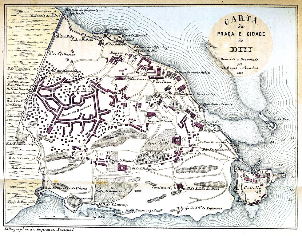
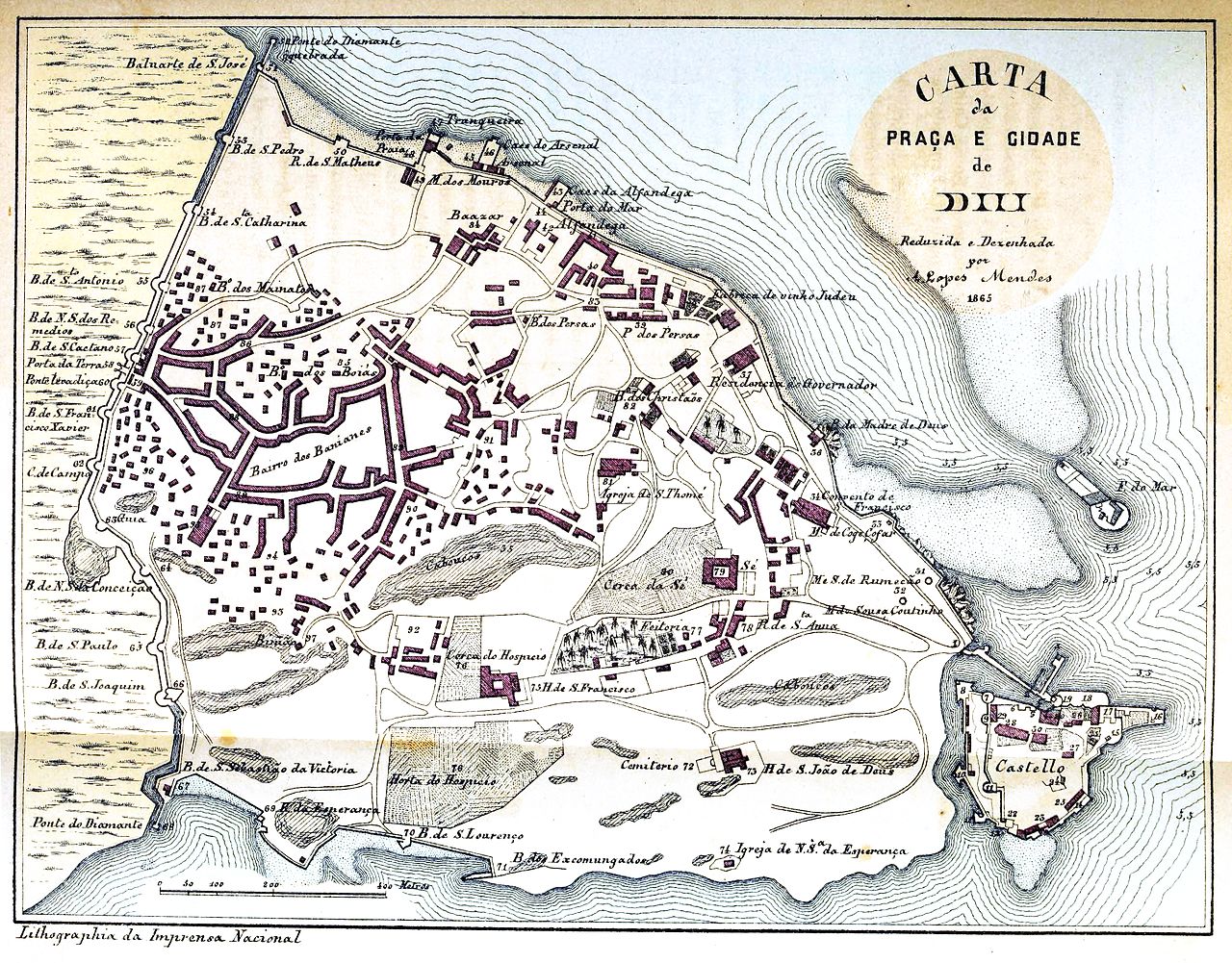
Map of Diu |
|||||||||
| Date | ||||||||||
| Source | A India portugueza; breve descripção das possessões portuguezas na Asia, dividida em dois volumes. Publicada por ordem do Ministerio da Marinha by Lopes Mendes, António, 1835-1894 | |||||||||
| Creator |
António Lopes Mendes |
|||||||||
| Permission (Reusing this file) |
|
|||||||||
| Geotemporal data | ||||||||||
| Bounding box |
|
|||||||||
| Georeferencing | ||||||||||
File history
Click on a date/time to view the file as it appeared at that time.
| Date/Time | Thumbnail | Dimensions | User | Comment | |
|---|---|---|---|---|---|
| current | 14:15, 3 December 2016 | | 2,040 × 1,596 (4.46 MB) | Shyamal | {{Information |Description=Map of Diu |Source=[https://archive.org/stream/indiaportuguezab02lope#page/n446/mode/1up A India portugueza; breve descripção das possessões portuguezas na Asia, dividida em dois volumes. Publicada por ordem do Ministerio... |
File usage
The following pages on the English Wikipedia use this file (pages on other projects are not listed):
Global file usage
The following other wikis use this file:
- Usage on pt.wikipedia.org