
File:DetroitRiverLocation.png

Size of this preview: 800 × 520 pixels. Other resolutions: 320 × 208 pixels | 640 × 416 pixels | 1,000 × 650 pixels.
Original file (1,000 × 650 pixels, file size: 426 KB, MIME type: image/png)
| This is a file from the Wikimedia Commons. Information from its description page there is shown below. Commons is a freely licensed media file repository. You can help. |
Summary
| Description |
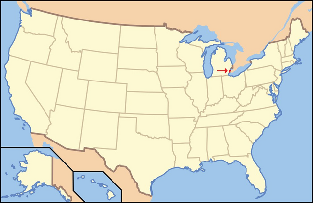
English: Modification of the US Locator Blank map for the Protected area infobox. This is used in the Detroit River article. |
| Date | 21 November 2010 (original upload date) |
| Source | Own work |
| Author | Addihockey10 at English Wikipedia |
Licensing
| This work has been released into the public domain by its author, Addihockey10 at English Wikipedia. This applies worldwide. In some countries this may not be legally possible; if so: Addihockey10 grants anyone the right to use this work for any purpose, without any conditions, unless such conditions are required by law. |
Original upload log
The original description page was here. All following user names refer to en.wikipedia.
- 2010-11-21 19:34 Addihockey10 1000×650 (436031 bytes) == Summary == Modification of the US Locator Blank map for the Protected area infobox. This is used in the Detroit River article. == Licensing == {{PD-self|date=December 2009}} [[Category:Images of Michigan]]
File history
Click on a date/time to view the file as it appeared at that time.
| Date/Time | Thumbnail | Dimensions | User | Comment | |
|---|---|---|---|---|---|
| current | 23:49, 1 January 2012 | | 1,000 × 650 (426 KB) | BotMultichillT | {{BotMoveToCommons|en.wikipedia|year={{subst:CURRENTYEAR}}|month={{subst:CURRENTMONTHNAME}}|day={{subst:CURRENTDAY}}}} == {{int:filedesc}} == {{Information |description={{en|1=Modification of the US Locator Blank map for the Protected area infobox. This |
File usage
No pages on the English Wikipedia use this file (pages on other projects are not listed).
Global file usage
The following other wikis use this file:
- Usage on af.wikipedia.org
- Usage on azb.wikipedia.org
- Usage on ca.wikipedia.org
- Usage on cs.wikipedia.org
- Usage on id.wikipedia.org
- Usage on vi.wikipedia.org