
File:DenmanArena Vancouver.jpg
Size of this preview: 800 × 465 pixels. Other resolutions: 320 × 186 pixels | 640 × 372 pixels | 1,024 × 595 pixels | 1,280 × 743 pixels | 2,411 × 1,400 pixels.
Original file (2,411 × 1,400 pixels, file size: 452 KB, MIME type: image/jpeg)
| This is a file from the Wikimedia Commons. Information from its description page there is shown below. Commons is a freely licensed media file repository. You can help. |
Summary
| Description |
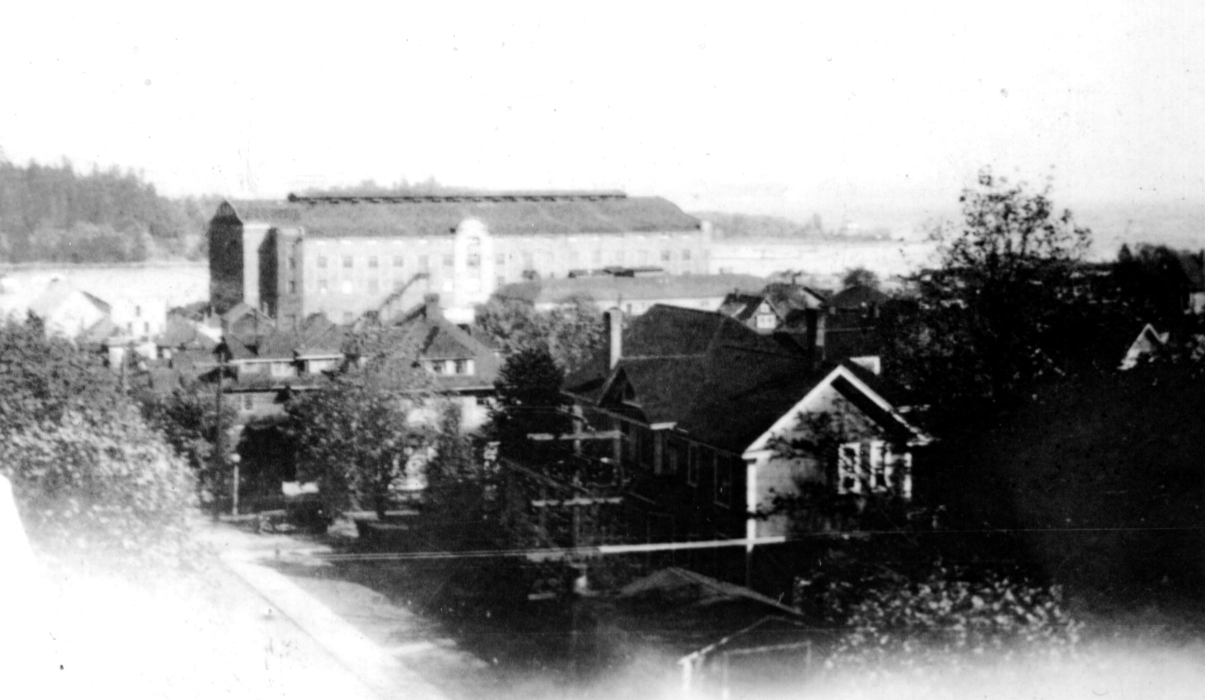
English: The Denman Arena and the West End neigbourhood of Vancouver, Canada, with part of Stanley Park in the background. This image is believed to have been taken from Chilco or Gilford Street, facing northeast. The arena was located at the corner of Denman Street and Georgia Street. |
| Date | Unknown date, prior to 1936 (when the Denman Arena burned down) |
| Source | Family of Robin Collins |
| Author | Probably Cecil L. Collins |
| Object location | | View this and other nearby images on: OpenStreetMap |
|---|
Licensing
| I, the copyright holder of this work, release this work into the public domain. This applies worldwide. In some countries this may not be legally possible; if so: I grant anyone the right to use this work for any purpose, without any conditions, unless such conditions are required by law. |
This Canadian work is in the public domain in Canada because its copyright has expired due to one of the following:
it was not subject to Crown copyright, and
|
 |
File history
Click on a date/time to view the file as it appeared at that time.
| Date/Time | Thumbnail | Dimensions | User | Comment | |
|---|---|---|---|---|---|
| current | 15:11, 18 November 2010 | | 2,411 × 1,400 (452 KB) | Robincollins | {{Information |Description={{en|1=the image is believed to have been taken from Georgia Street (or even Alberni Street), looking towards Stanley Park (West, or North West). The large building was a large ice rink arena called the Vancouver Arena (sometime |
File usage
The following pages on the English Wikipedia use this file (pages on other projects are not listed):