
File:Delaware and Chesapeake Bays satellite image.jpg

Size of this preview: 480 × 600 pixels. Other resolutions: 192 × 240 pixels | 600 × 750 pixels.
Original file (600 × 750 pixels, file size: 218 KB, MIME type: image/jpeg)
| This is a file from the Wikimedia Commons. Information from its description page there is shown below. Commons is a freely licensed media file repository. You can help. |
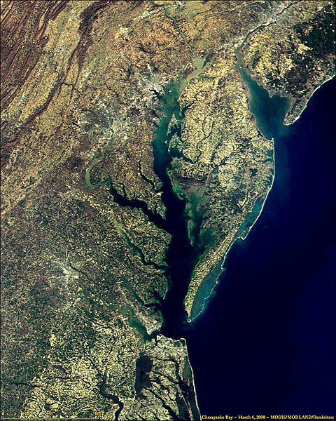
- Description
- Satellite picture of Chesapeake Bay (center) and Delaware Bay (upper right), on the central East Coast of the United States.
- The Delaware Bay is located north of the Chesapeake Bay on the Atlantic Ocean.
- Credits
- NASA image taken by MODIS. Website @ Media Page archive copy at the Wayback Machine.
- Uploaded by Edbrown05 00:36, 11 May 2005 (UTC)
| This file is in the public domain in the United States because it was solely created by NASA. NASA copyright policy states that "NASA material is not protected by copyright unless noted". (See Template:PD-USGov, NASA copyright policy page or JPL Image Use Policy.) | ||
 |
Warnings:
|
File history
Click on a date/time to view the file as it appeared at that time.
| Date/Time | Thumbnail | Dimensions | User | Comment | |
|---|---|---|---|---|---|
| current | 00:36, 11 May 2005 | | 600 × 750 (218 KB) | Edbrown05~commonswiki | NASA image taken by MODIS. Website @ [http://modis.gsfc.nasa.gov/about/media.html Media Page]. Uploaded by ~~~~ {{PD}} Category:Bays |
File usage
The following pages on the English Wikipedia use this file (pages on other projects are not listed):
Global file usage
The following other wikis use this file:
- Usage on bo.wikipedia.org
- Usage on cs.wikipedia.org
- Usage on de.wikipedia.org
- Usage on en.wikinews.org
- Usage on frr.wikipedia.org
- Usage on fr.wikipedia.org
- Usage on it.wikipedia.org
- Usage on nl.wikipedia.org
- Usage on www.wikidata.org