
File:Delaware Basin map.PNG
Size of this preview: 800 × 506 pixels. Other resolutions: 320 × 202 pixels | 640 × 405 pixels | 1,160 × 734 pixels.
Original file (1,160 × 734 pixels, file size: 123 KB, MIME type: image/png)
| This is a file from the Wikimedia Commons. Information from its description page there is shown below. Commons is a freely licensed media file repository. You can help. |
Summary
| Description |
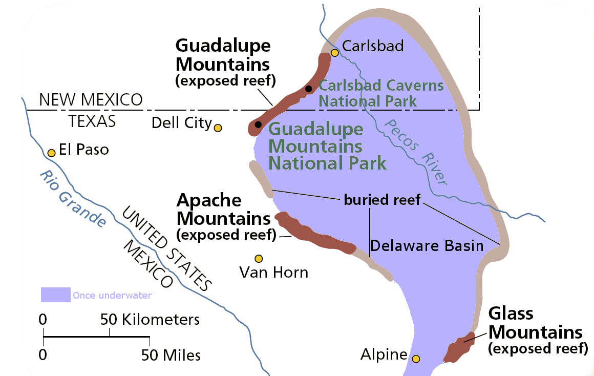
English: Map of the Delaware Basin — a geologic depositional and structural basin in West Texas and southeastern New Mexico.
|
| Date | Unknown date |
| Source | Own work |
| Author | National Park Service |
| Permission (Reusing this file) |
From pdf linked from http://www.nps.gov/gumo/naturescience/geologicformations.htm Edited using the GIMP. I place those edits in the public domain. |
Licensing
| This image or media file contains material based on a work of a National Park Service employee, created as part of that person's official duties. As a work of the U.S. federal government, such work is in the public domain in the United States. See the NPS website and NPS copyright policy for more information. |
File history
Click on a date/time to view the file as it appeared at that time.
| Date/Time | Thumbnail | Dimensions | User | Comment | |
|---|---|---|---|---|---|
| current | 02:39, 1 August 2007 | | 1,160 × 734 (123 KB) | Mav | from pdf linked from http://www.nps.gov/gumo/naturescience/geologicformations.htm Edited using the GIMP. I place those edits in the public domain. |
File usage
The following pages on the English Wikipedia use this file (pages on other projects are not listed):
Global file usage
The following other wikis use this file:
- Usage on es.wikipedia.org
- Usage on he.wikipedia.org
- Usage on it.wikipedia.org
- Usage on uk.wikipedia.org
- Usage on www.wikidata.org