
File:De Smet map of the 1851 Fort Laramie Indian territories (the light area). PNG.png

Size of this preview: 800 × 536 pixels. Other resolutions: 320 × 214 pixels | 640 × 429 pixels | 1,024 × 686 pixels | 1,280 × 857 pixels | 2,560 × 1,714 pixels | 4,255 × 2,849 pixels.
Original file (4,255 × 2,849 pixels, file size: 20.73 MB, MIME type: image/png)
| This is a file from the Wikimedia Commons. Information from its description page there is shown below. Commons is a freely licensed media file repository. You can help. |
._PNG.png)
Summary
| Description |
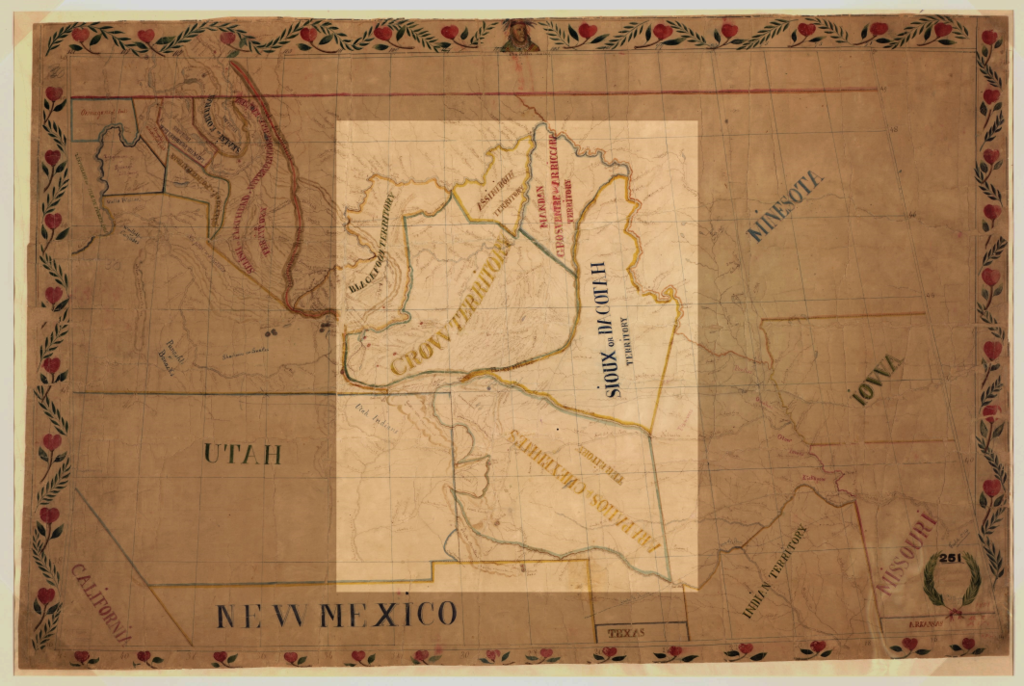
English: Map of Pierre-Jean De Smet in 1851. The Indian territories agreed upon in the Fort Laramie Treaty (1851) is shown in the light area: Assiniboine, Arikara, Hidatsa and Mandan, Sioux (Dakota or Lakota), Crow, Arapaho and Cheyenne |
| Date | |
| Source | Map of the upper Great Plains and Rocky Mountains region. |
| Author | Pierre-Jean De Smet (1801-1873) |
North America, US, North Dakota, South Dakota, Montana, Nebraska, Colorado, Wyoming
Licensing
|
This work is in the public domain in its country of origin and other countries and areas where the copyright term is the author's life plus 70 years or fewer. This work is in the public domain in the United States because it was published (or registered with the U.S. Copyright Office) before January 1, 1929. | |
| This file has been identified as being free of known restrictions under copyright law, including all related and neighboring rights. | |
File history
Click on a date/time to view the file as it appeared at that time.
| Date/Time | Thumbnail | Dimensions | User | Comment | |
|---|---|---|---|---|---|
| current | 05:47, 19 May 2018 | | 4,255 × 2,849 (20.73 MB) | Naawada2016 | User created page with UploadWizard |
File usage
The following pages on the English Wikipedia use this file (pages on other projects are not listed):
._PNG.png)