
File:Cyclists on the South Tyne Trail near Lambley - geograph.org.uk - 886415.jpg
No higher resolution available.
Cyclists_on_the_South_Tyne_Trail_near_Lambley_-_geograph.org.uk_-_886415.jpg (640 × 480 pixels, file size: 82 KB, MIME type: image/jpeg)
| This is a file from the Wikimedia Commons. Information from its description page there is shown below. Commons is a freely licensed media file repository. You can help. |
Summary
| Description |
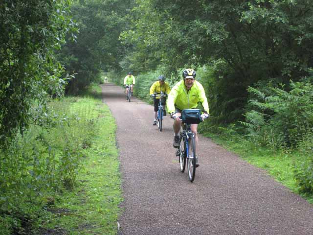
English: Cyclists on the South Tyne Trail near Lambley Trackbed of the old railway which once ran from Haltwhistle to Alston http://www.visitcumbria.com/pen/haltalst.htm http://www.railbrit.co.uk/Alston_Branch/frame.htm. Built in 1846, the line was recommended for closure by Beeching but was reprieved because there was no adequate road access to Alston in the worst of winter weather. The line was eventually closed in 1976. Much of the line now forms part of the South Tyne Trail for walkers and cyclists http://www.northpennines.org.uk/index.cfm?articleid=5187. The Trail is also followed some of the way by the Pennine Cycleway, route 68 of the National Cycle Network http://www.cycle-routes.org/penninecycleway/. |
| Date | |
| Source | From geograph.org.uk |
| Author | Oliver Dixon |
| Attribution (required by the license) | Oliver Dixon / Cyclists on the South Tyne Trail near Lambley / |
| Camera location | | View this and other nearby images on: OpenStreetMap |
|---|
_heading:157.00&language=en)
| Object location | | View this and other nearby images on: OpenStreetMap |
|---|
_heading:157.00&language=en)
Licensing

|
This image was taken from the Geograph project collection. See this photograph's page on the Geograph website for the photographer's contact details. The copyright on this image is owned by Oliver Dixon and is licensed for reuse under the Creative Commons Attribution-ShareAlike 2.0 license.
|
This file is licensed under the Creative Commons Attribution-Share Alike 2.0 Generic license.
Attribution: Oliver Dixon
- You are free:
- to share – to copy, distribute and transmit the work
- to remix – to adapt the work
- Under the following conditions:
- attribution – You must give appropriate credit, provide a link to the license, and indicate if changes were made. You may do so in any reasonable manner, but not in any way that suggests the licensor endorses you or your use.
- share alike – If you remix, transform, or build upon the material, you must distribute your contributions under the same or compatible license as the original.
File history
Click on a date/time to view the file as it appeared at that time.
| Date/Time | Thumbnail | Dimensions | User | Comment | |
|---|---|---|---|---|---|
| current | 12:10, 21 February 2011 | | 640 × 480 (82 KB) | GeographBot | == {{int:filedesc}} == {{Information |description={{en|1=Cyclists on the South Tyne Trail near Lambley Trackbed of the old railway which once ran from Haltwhistle to Alston http://www.visitcumbria.com/pen/haltalst.htm http://www.railbrit.co.uk/Alston_Bran |
File usage
The following pages on the English Wikipedia use this file (pages on other projects are not listed):