
File:Covent Garden from the Ralph Agas 1572 map of London - marked.jpg
Size of this preview: 800 × 536 pixels. Other resolutions: 320 × 214 pixels | 640 × 429 pixels | 821 × 550 pixels.
Original file (821 × 550 pixels, file size: 524 KB, MIME type: image/jpeg)
| This is a file from the Wikimedia Commons. Information from its description page there is shown below. Commons is a freely licensed media file repository. You can help. |
| Description |
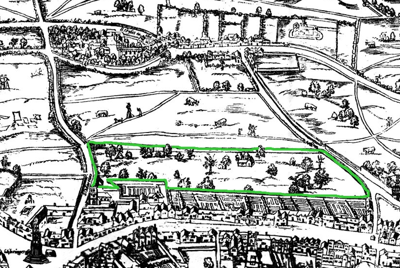
Small detail of the Ralph Agas London map of 1572. Modern marks in green of streets, and in yellow of Covent Garden wall. English: The earliest proper map (as opposed to panorama) of London known. Attributed to Ralph Agas, and probably surveyed between 1570 and 1605. The original was 6 foot 0.5 inches long by 2 feet 4.5 inches wide. This much reduced image is a scan of a copy of a lithograph of a copy, was itself badly repaired with sellotape and has had to be "restored"; so is hardly a truly faithful representation of the original, but few good copies exist and no other detailed public domain images are known. |
| Date | (UTC) |
| Source | |
| Author |
|
| This is a retouched picture, which means that it has been digitally altered from its original version. Modifications: Covent Garden marked in green. The original can be viewed here: Covent Garden from the Ralph Agas 1572 map of London.jpg:
|
This work is based on a work in the public domain. It has been digitally enhanced and/or modified. This derivative work has been (or is hereby) released into the public domain by its author, [[:c:User:{{{1}}}|{{{1}}}]]. This applies worldwide.
In some countries this may not be legally possible; if so: |
Original upload log
This image is a derivative work of the following images:
- File:Covent_Garden_from_the_Ralph_Agas_1572_map_of_London.jpg licensed with PD-self
- 2010-08-12T18:15:34Z SilkTork 821x550 (545301 Bytes) {{Information |Description=Small detail of the Ralph Agas London map of 1572. Modern marks in green of streets, and in yellow of Covent Garden wall. {{en|1=The earliest proper map (as opposed to panorama) of London known. A
Uploaded with derivativeFX
File history
Click on a date/time to view the file as it appeared at that time.
| Date/Time | Thumbnail | Dimensions | User | Comment | |
|---|---|---|---|---|---|
| current | 07:35, 23 August 2010 | | 821 × 550 (524 KB) | SilkTork | {{Information |Description=Small detail of the Ralph Agas London map of 1572. Modern marks in green of streets, and in yellow of Covent Garden wall. {{en|1=The earliest proper map (as opposed to panorama) of London known. Attributed to Ralph Agas, and p |
File usage
The following pages on the English Wikipedia use this file (pages on other projects are not listed):
Global file usage
The following other wikis use this file:
- Usage on ar.wikipedia.org
- Usage on azb.wikipedia.org
- Usage on ja.wikipedia.org
- Usage on pt.wikipedia.org
- Usage on ru.wikipedia.org
- Usage on vi.wikipedia.org
- Usage on zh.wikipedia.org