
File:Corp of Eng. 6-15-11 108.jpg
Size of this preview: 800 × 496 pixels. Other resolutions: 320 × 198 pixels | 640 × 397 pixels | 1,024 × 635 pixels | 1,280 × 794 pixels | 2,064 × 1,280 pixels.
Original file (2,064 × 1,280 pixels, file size: 1.45 MB, MIME type: image/jpeg)
| This is a file from the Wikimedia Commons. Information from its description page there is shown below. Commons is a freely licensed media file repository. You can help. |
Summary
| Description |
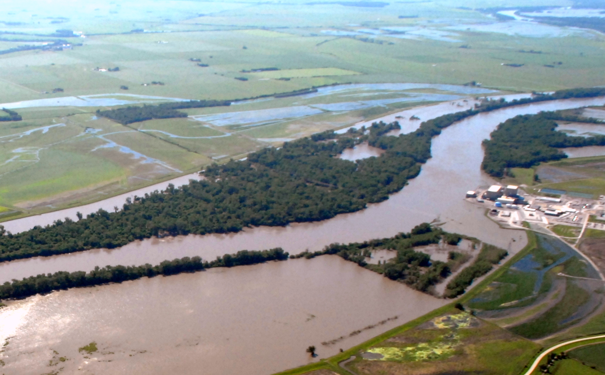
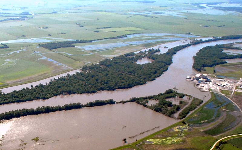
English: Cooper Nuclear Power Plant on the edge of the 2011 Missouri River Floods on June 15, 2011 |
| Date | |
| Source | http://www.nwo.usace.army.mil/html/op-e/Photos/Mo%20River%20Rulo%20to%20Blair%2015%20June%202011/NE-PlatteRiv-Rulo.pdf |
| Author | U.S. Army Corp of Engineers |
| Camera location | | View this and other nearby images on: OpenStreetMap |
|---|
Licensing
This file is a work of a U.S. Army soldier or employee, taken or made as part of that person's official duties. As a work of the U.S. federal government, it is in the public domain in the United States.
|
 |
File history
Click on a date/time to view the file as it appeared at that time.
| Date/Time | Thumbnail | Dimensions | User | Comment | |
|---|---|---|---|---|---|
| current | 04:20, 22 June 2011 | | 2,064 × 1,280 (1.45 MB) | Americasroof |
File usage
The following pages on the English Wikipedia use this file (pages on other projects are not listed):
Global file usage
The following other wikis use this file:
- Usage on ar.wikipedia.org
- Usage on br.wikipedia.org
- Usage on de.wikipedia.org
- Usage on es.wikipedia.org
- Usage on fr.wikipedia.org
- Usage on ja.wikipedia.org
- Usage on no.wikipedia.org
- Usage on www.wikidata.org