
File:Cornet Rock position.png
No higher resolution available.
Cornet_Rock_position.png (424 × 349 pixels, file size: 435 KB, MIME type: image/png)
| This is a file from the Wikimedia Commons. Information from its description page there is shown below. Commons is a freely licensed media file repository. You can help. |

|
This map image could be re-created using vector graphics as an SVG file. This has several advantages; see Commons:Media for cleanup for more information. If an SVG form of this image is available, please upload it and afterwards replace this template with
{{vector version available|new image name}}.
It is recommended to name the SVG file “Cornet Rock position.svg”—then the template Vector version available (or Vva) does not need the new image name parameter. |
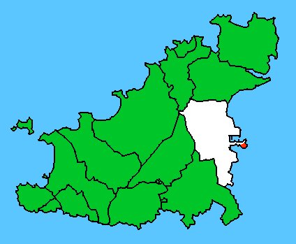
| Description | Map basis: Civil Parish Map of Guernesey. Parish of Saint Peter Port is white. Cornet Rock (Castle Cornet) within Saint Peter Port is red. |
| Date | (UTC) |
| Source | |
| Author |
|
| This is a retouched picture, which means that it has been digitally altered from its original version. Modifications: marked location of Cornet Rock (Castle Cornet) red. The original can be viewed here: Gu spp.jpg:
|
I, the copyright holder of this work, hereby publish it under the following licenses:
This file is licensed under the Creative Commons Attribution-Share Alike 2.5 Generic, 2.0 Generic and 1.0 Generic license.
- You are free:
- to share – to copy, distribute and transmit the work
- to remix – to adapt the work
- Under the following conditions:
- attribution – You must give appropriate credit, provide a link to the license, and indicate if changes were made. You may do so in any reasonable manner, but not in any way that suggests the licensor endorses you or your use.
- share alike – If you remix, transform, or build upon the material, you must distribute your contributions under the same or compatible license as the original.
| This file is licensed under the Creative Commons Attribution-Share Alike 3.0 Unported license. | ||
| ||
| This licensing tag was added to this file as part of the GFDL licensing update. |

|
Permission is granted to copy, distribute and/or modify this document under the terms of the GNU Free Documentation License, Version 1.2 or any later version published by the Free Software Foundation; with no Invariant Sections, no Front-Cover Texts, and no Back-Cover Texts. A copy of the license is included in the section entitled GNU Free Documentation License. |
You may select the license of your choice.
Original upload log
This image is a derivative work of the following images:
- File:Gu_spp.jpg licensed with Cc-by-sa-2.5,2.0,1.0, Cc-by-sa-3.0-migrated, GFDL
- 2006-12-16T17:41:38Z Brieg 424x349 (26469 Bytes) == Summary == {{Information |Description=Carte des paroisses de Guernesey. Situation de la paroisse de Saint-Pierre-Port ( en blanc sur la carte). |Source=[[:fr:Utilisateur:Fitzwarin|Fitzwarin]] 7 janvier 2006
Uploaded with derivativeFX
File history
Click on a date/time to view the file as it appeared at that time.
| Date/Time | Thumbnail | Dimensions | User | Comment | |
|---|---|---|---|---|---|
| current | 18:24, 13 February 2010 | | 424 × 349 (435 KB) | Ratzer | {{Information |Description=Carte des paroisses de Guernesey. Situation de la paroisse de Saint-Pierre-Port ( en blanc sur la carte). |Source=*File:Gu_spp.jpg |Date=2010-02-13 18:22 (UTC) |Author=*File:Gu_spp.jpg: Brieg *derivati |
File usage
The following pages on the English Wikipedia use this file (pages on other projects are not listed):
Global file usage
The following other wikis use this file:
- Usage on ceb.wikipedia.org
- Usage on de.wikipedia.org
- Usage on sv.wikipedia.org
- Usage on www.wikidata.org
- Usage on zh.wikipedia.org