
File:Compton Park House - Compton Chamberlayne - geograph.org.uk - 682307.jpg
No higher resolution available.
Compton_Park_House_-_Compton_Chamberlayne_-_geograph.org.uk_-_682307.jpg (640 × 427 pixels, file size: 188 KB, MIME type: image/jpeg)
| This is a file from the Wikimedia Commons. Information from its description page there is shown below. Commons is a freely licensed media file repository. You can help. |
Summary
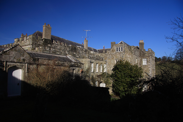
This is a photo of listed building number 1146151. |
| Description |
English: Compton Park House - Compton Chamberlayne This is about all one can see of Compton Park House, despite its close proximity to the churchyard from where this photo was taken. A C17 country house, it was acquired by Edward Penruddocke in circa 1600, and underwent alterations in the late C17. It was externally rebuilt in 1780 by Charles Penruddocke. The Penruddocke family were staunch Royalists during the English Civil War. Grade I Listed. |
| Date | |
| Source | From geograph.org.uk |
| Author | Mike Searle |
| Attribution (required by the license) | Mike Searle / Compton Park House - Compton Chamberlayne / |
| Camera location | | View this and other nearby images on: OpenStreetMap |
|---|
_heading:67.00&language=en)
| Object location | | View this and other nearby images on: OpenStreetMap |
|---|
_heading:67.00&language=en)
Licensing

|
This image was taken from the Geograph project collection. See this photograph's page on the Geograph website for the photographer's contact details. The copyright on this image is owned by Mike Searle and is licensed for reuse under the Creative Commons Attribution-ShareAlike 2.0 license.
|
This file is licensed under the Creative Commons Attribution-Share Alike 2.0 Generic license.
Attribution: Mike Searle
- You are free:
- to share – to copy, distribute and transmit the work
- to remix – to adapt the work
- Under the following conditions:
- attribution – You must give appropriate credit, provide a link to the license, and indicate if changes were made. You may do so in any reasonable manner, but not in any way that suggests the licensor endorses you or your use.
- share alike – If you remix, transform, or build upon the material, you must distribute your contributions under the same or compatible license as the original.
File history
Click on a date/time to view the file as it appeared at that time.
| Date/Time | Thumbnail | Dimensions | User | Comment | |
|---|---|---|---|---|---|
| current | 01:14, 8 February 2011 | | 640 × 427 (188 KB) | GeographBot | == {{int:filedesc}} == {{Information |description={{en|1=Compton Park House - Compton Chamberlayne This is about all one can see of Compton Park House, despite its close proximity to the churchyard from where this photo was taken. A C17 country house, it |
File usage
The following pages on the English Wikipedia use this file (pages on other projects are not listed):
Global file usage
The following other wikis use this file:
- Usage on dag.wikipedia.org
- Usage on www.wikidata.org