
File:Colwick Marshalling Yard geograph-2986296-by-Ben-Brooksbank.jpg
Size of this preview: 800 × 569 pixels. Other resolutions: 320 × 228 pixels | 640 × 455 pixels | 1,024 × 728 pixels | 1,280 × 911 pixels | 2,034 × 1,447 pixels.
Original file (2,034 × 1,447 pixels, file size: 1.28 MB, MIME type: image/jpeg)
| This is a file from the Wikimedia Commons. Information from its description page there is shown below. Commons is a freely licensed media file repository. You can help. |
Summary
| Description |
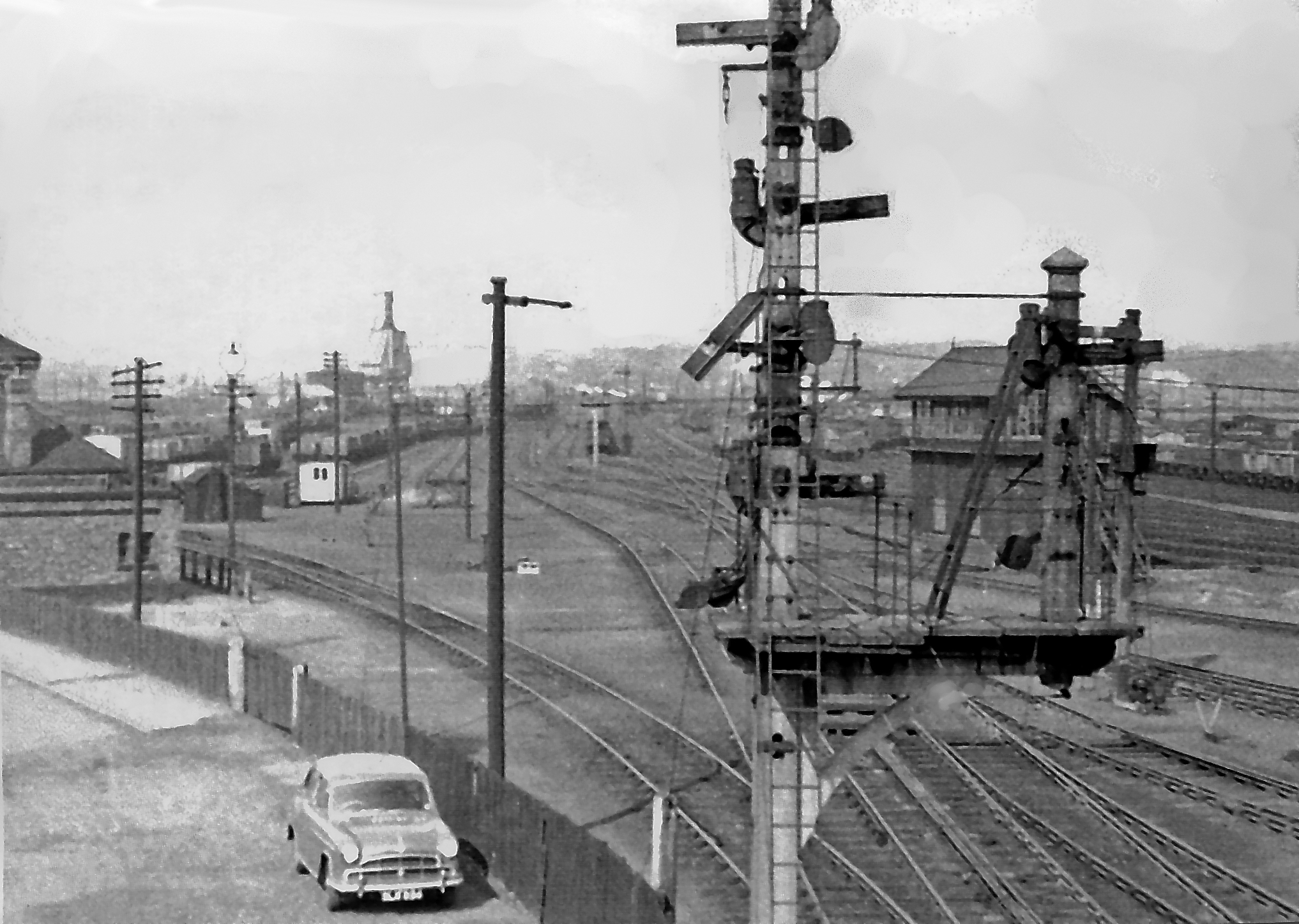
English: Colwick Yard Complex. View [probably] WNW, to the western part of the vast ex-LNER Colwick Yards and towards Gedling etc. on the Nottingham Avoiding Line. The signalbox is [probably] Locomotive Junction, the great Locomotive Depot, with an allocation of over 200 engines is off to the left. [It was a very difficult complex to access from public roads. My car is in the foreground, and how I got up so high is a mystery to me. Better elucidation by someone else would be welcome]. Fifty years ago, this was a very major railway centre, dealing with an immense freight traffic, especially coal, but all has long since gone in the modern age. |
| Date | |
| Source | From geograph.org.uk |
| Author | Ben Brooksbank |
| Permission (Reusing this file) |
Creative Commons Attribution Share-alike license 2.0 |
| Camera location | | View this and other nearby images on: OpenStreetMap |
|---|
Licensing

|
This image was taken from the Geograph project collection. See this photograph's page on the Geograph website for the photographer's contact details. The copyright on this image is owned by Ben Brooksbank and is licensed for reuse under the Creative Commons Attribution-ShareAlike 2.0 license.
|
This file is licensed under the Creative Commons Attribution-Share Alike 2.0 Generic license.
Attribution: Ben Brooksbank
- You are free:
- to share – to copy, distribute and transmit the work
- to remix – to adapt the work
- Under the following conditions:
- attribution – You must give appropriate credit, provide a link to the license, and indicate if changes were made. You may do so in any reasonable manner, but not in any way that suggests the licensor endorses you or your use.
- share alike – If you remix, transform, or build upon the material, you must distribute your contributions under the same or compatible license as the original.
File history
Click on a date/time to view the file as it appeared at that time.
| Date/Time | Thumbnail | Dimensions | User | Comment | |
|---|---|---|---|---|---|
| current | 18:25, 13 June 2012 | | 2,034 × 1,447 (1.28 MB) | Chevin | == {{int:filedesc}} == {{Information |Description={{en|1='''Colwick Yard Complex.'''<br/> View [probably] WNW, to the western part of the vast ex-LNER Colwick Yards and towards Gedling etc. on the Nottingham Avoiding Line. The signalbox is [probably] L... |
File usage
The following pages on the English Wikipedia use this file (pages on other projects are not listed):
Global file usage
The following other wikis use this file:
- Usage on www.wikidata.org