
File:ClearwaterEscarpment-Lewiston-USDA-1917.png
No higher resolution available.
ClearwaterEscarpment-Lewiston-USDA-1917.png (595 × 464 pixels, file size: 301 KB, MIME type: image/png)
| This is a file from the Wikimedia Commons. Information from its description page there is shown below. Commons is a freely licensed media file repository. You can help. |
Summary
| Description |
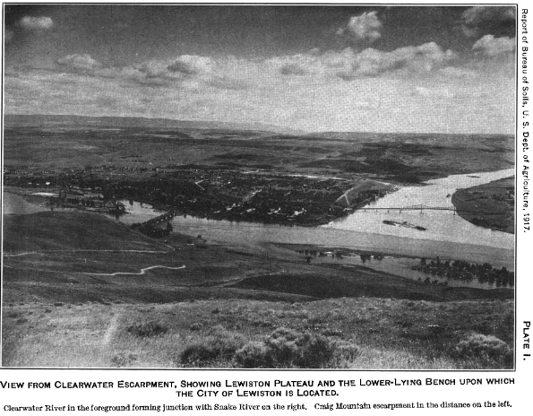
English: Clearwater River in the foreground forming junction with Snake River on the right. Craig Mountain escarpment in the distance on the left. Photo credit: United States Department of Agriculture, 1917. |
| Date | |
| Source | https://www.nrcs.usda.gov/Internet/FSE_MANUSCRIPTS/idaho/nezperce&lewisID1920/nezperce&lewisID1920.pdf |
| Author | USDA |
| Camera location | | View this and other nearby images on: OpenStreetMap |
|---|
,
Licensing
This image or file is a work of a United States Department of Agriculture employee, taken or made as part of that person's official duties. As a work of the U.S. federal government, the image is in the public domain.
|
 |
File history
Click on a date/time to view the file as it appeared at that time.
| Date/Time | Thumbnail | Dimensions | User | Comment | |
|---|---|---|---|---|---|
| current | 23:33, 14 January 2021 | | 595 × 464 (301 KB) | RobLa | Uploaded a work by USDA from https://www.nrcs.usda.gov/Internet/FSE_MANUSCRIPTS/idaho/nezperce&lewisID1920/nezperce&lewisID1920.pdf with UploadWizard |
File usage
The following pages on the English Wikipedia use this file (pages on other projects are not listed):