
File:China agricultural 1986.jpg

Size of this preview: 724 × 600 pixels. Other resolutions: 290 × 240 pixels | 580 × 480 pixels | 927 × 768 pixels | 1,024 × 848 pixels.
Original file (1,024 × 848 pixels, file size: 97 KB, MIME type: image/jpeg)
| This is a file from the Wikimedia Commons. Information from its description page there is shown below. Commons is a freely licensed media file repository. You can help. |
| Description |
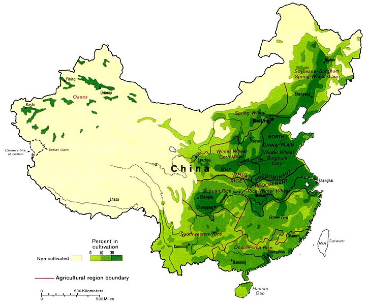
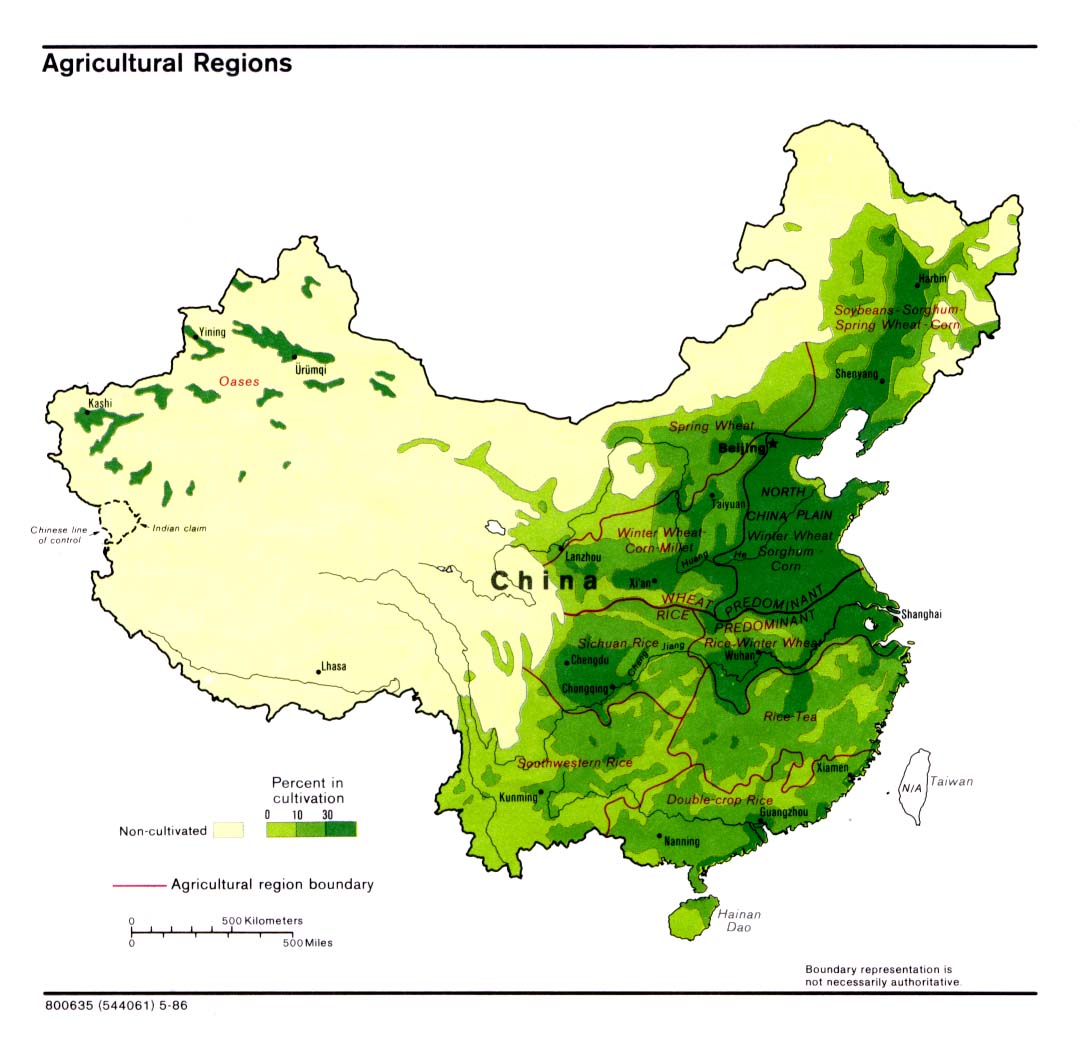
English: Maps of China: Agricultural regions of China – Note: Boundary representation is not necessarily authoritative. |
|||
| Date | ||||
| Source | Map No. 800635 (544061) 5-86 – produced by the U.S. Central Intelligence Agency – see also China Maps Collection | |||
| Author | Unknown author (U.S. Central Intelligence Agency) | |||
| Permission (Reusing this file) |
|

File history
Click on a date/time to view the file as it appeared at that time.
| Date/Time | Thumbnail | Dimensions | User | Comment | |
|---|---|---|---|---|---|
| current | 13:04, 13 April 2010 | | 1,024 × 848 (97 KB) | Ras67 | losslessly cropped with Jpegcrop |
| 04:58, 15 January 2005 |  | 1,084 × 1,039 (127 KB) | Ran | {{PD-USGov}} |
File usage
The following pages on the English Wikipedia use this file (pages on other projects are not listed):
Global file usage
The following other wikis use this file:
- Usage on ar.wikipedia.org
- Usage on ast.wikipedia.org
- Usage on ca.wikipedia.org
- Usage on de.wikipedia.org
- Usage on es.wikipedia.org
- Usage on es.wikibooks.org
- Usage on fr.wikipedia.org
- Usage on fr.wiktionary.org
- Usage on gl.wikipedia.org
- Usage on id.wikipedia.org
- Usage on ka.wikipedia.org
- Usage on ru.wikipedia.org
- Usage on sh.wikipedia.org
- Usage on zh.wikipedia.org