
File:Chicago L Future.svg

Size of this PNG preview of this SVG file: 374 × 599 pixels. Other resolutions: 150 × 240 pixels | 300 × 480 pixels | 479 × 768 pixels | 639 × 1,024 pixels | 1,279 × 2,048 pixels | 1,530 × 2,450 pixels.
Original file (SVG file, nominally 1,530 × 2,450 pixels, file size: 158 KB)
| This is a file from the Wikimedia Commons. Information from its description page there is shown below. Commons is a freely licensed media file repository. You can help. |
Summary
| Description |
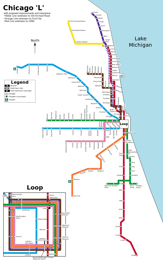
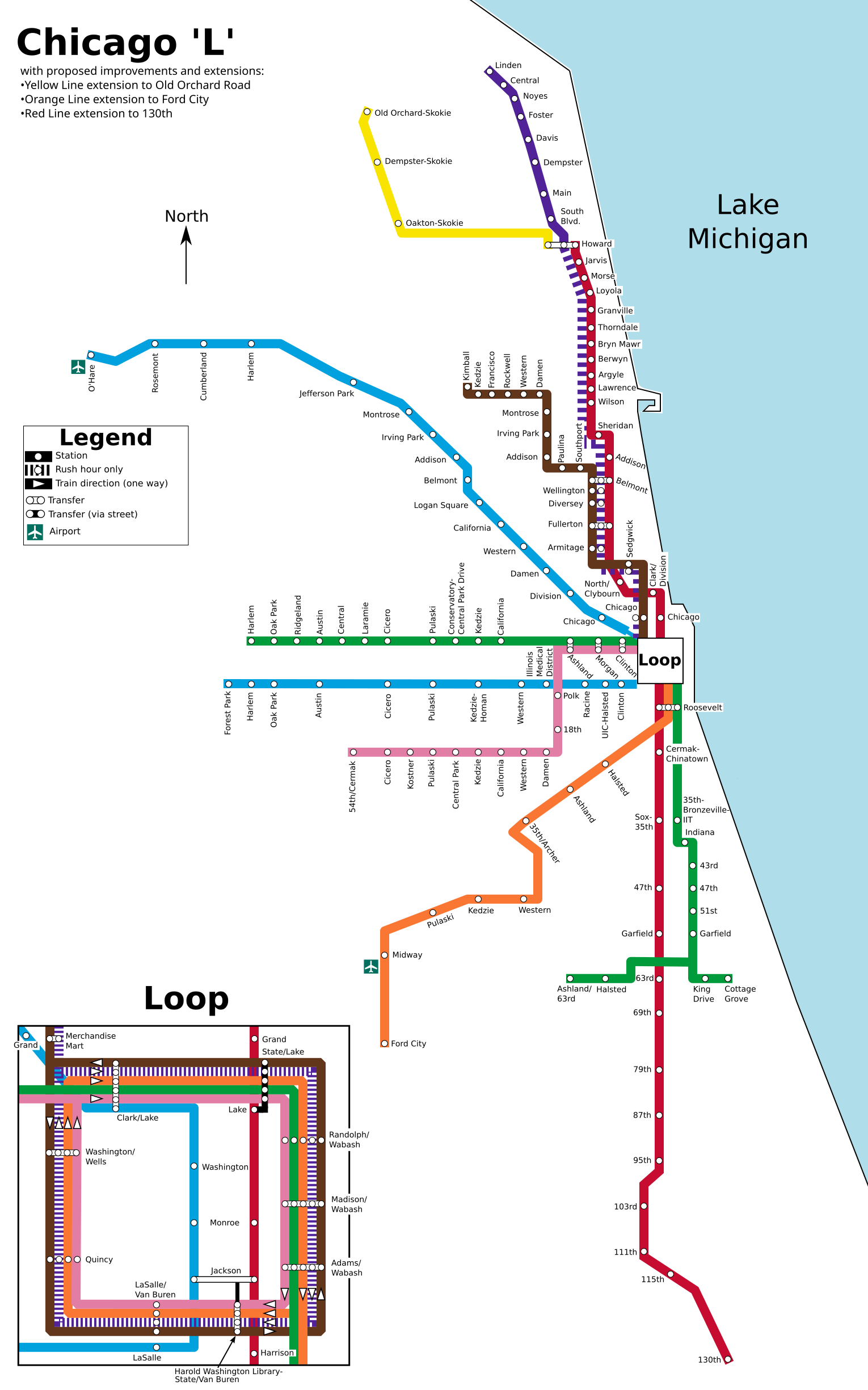
English: Map of the w:Chicago 'L' with the following planned improvements and expansions:
|
| Date | |
| Source | Own work |
| Author | BorgHunter |
| Other versions | File:Chicago L Map.svg |
Licensing
I, the copyright holder of this work, hereby publish it under the following license:
This file is licensed under the Creative Commons Attribution-Share Alike 3.0 Unported license.
- You are free:
- to share – to copy, distribute and transmit the work
- to remix – to adapt the work
- Under the following conditions:
- attribution – You must give appropriate credit, provide a link to the license, and indicate if changes were made. You may do so in any reasonable manner, but not in any way that suggests the licensor endorses you or your use.
- share alike – If you remix, transform, or build upon the material, you must distribute your contributions under the same or compatible license as the original.
File history
Click on a date/time to view the file as it appeared at that time.
| Date/Time | Thumbnail | Dimensions | User | Comment | |
|---|---|---|---|---|---|
| current | 17:28, 18 May 2012 | | 1,530 × 2,450 (158 KB) | BorgHunter | Morgan is no longer planned, as it has opened. |
| 00:11, 30 April 2012 |  | 1,530 × 2,450 (158 KB) | BorgHunter | Remove Oakton-Skokie from list of differences, as it opens tomorrow. | |
| 11:09, 24 June 2011 |  | 1,530 × 2,450 (138 KB) | BorgHunter | Update names of Yellow Line stations | |
| 16:14, 23 January 2011 |  | 1,530 × 2,450 (138 KB) | BorgHunter | Update to sync up with main map | |
| 14:54, 4 July 2010 |  | 725 × 1,200 (149 KB) | BorgHunter | {{Information |Description={{en|1=Map of the w:Chicago 'L' with the following planned improvements and expansions: with proposed improvements and extensions: •Morgan/Lake station •Oakton/U.S. 41 station •Yellow Line extension to Old Orchard Road |
File usage
No pages on the English Wikipedia use this file (pages on other projects are not listed).
Global file usage
The following other wikis use this file:
- Usage on zh.wikipedia.org