
File:ChiPitts area.png
No higher resolution available.
ChiPitts_area.png (300 × 300 pixels, file size: 23 KB, MIME type: image/png)
| This is a file from the Wikimedia Commons. Information from its description page there is shown below. Commons is a freely licensed media file repository. You can help. |
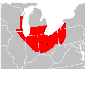
| Description | en:ChiPitts (Chicago-Pittsburg) megalopolis area in red. Major cities are shown with a black dot |
| Source | Image made from BlankMap-USA-states.PNG, modified to show approximate boundaries of the ChiPitts |
| Author | Ctjf83 |
| Other versions | en:Image:ChiPitts_area.png |
| |
This work has been released into the public domain by its author, Ctjf83, at the English Wikipedia project. This applies worldwide. In case this is not legally possible: |
File history
Click on a date/time to view the file as it appeared at that time.
| Date/Time | Thumbnail | Dimensions | User | Comment | |
|---|---|---|---|---|---|
| current | 14:27, 14 March 2008 | | 300 × 300 (23 KB) | Pierre cb | {{Information |Description=en:ChiPitts megalopolis area in red. Major cities are shown with a black dot |Source=Image made from [http://commons.wikimedia.org/wiki/Image:BlankMap-USA-states.PNG BlankMap-USA-states.PNG], modified to show approximate b |
File usage
No pages on the English Wikipedia use this file (pages on other projects are not listed).
Global file usage
The following other wikis use this file:
- Usage on ca.wikipedia.org
- Usage on cs.wikipedia.org
- Usage on de.wikipedia.org
- Usage on eo.wikipedia.org
- Usage on fr.wikipedia.org
- Usage on mk.wikipedia.org
- Usage on pt.wikipedia.org
- Usage on uk.wikipedia.org
- Usage on www.wikidata.org
- Usage on zh.wikibooks.org