
File:Chester-Whitchurch railway (disused) - geograph.org.uk - 144331.jpg
No higher resolution available.
Chester-Whitchurch_railway_(disused)_-_geograph.org.uk_-_144331.jpg (640 × 480 pixels, file size: 116 KB, MIME type: image/jpeg)
| This is a file from the Wikimedia Commons. Information from its description page there is shown below. Commons is a freely licensed media file repository. You can help. |
| Description |
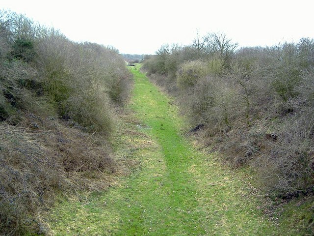
English: Chester-Whitchurch railway (disused) Cutting on the disused Chester-Whitchurch railway line, looking south from the bridge on footpath Broxton 9. This line was opened in 1872 and left the Crewe-Chester North Wales Coast railway at Tattenhall junction. The track bed is now a DEFRA Conservation walk - but unfortunately a cul-de-sac with no access from the bridge at this point. |
||
| Date | |||
| Source | From geograph.org.uk | ||
| Author | Mike Harris | ||
| Permission (Reusing this file) |
This file is licensed under the Creative Commons Attribution-Share Alike 2.0 Generic license. Attribution: Mike Harris
|
||
| Attribution (required by the license) | Mike Harris / Chester-Whitchurch railway (disused) / | ||

_-_geograph.org.uk_-_144331.jpg)
| Object location | | View this and other nearby images on: OpenStreetMap |
|---|
_-_geograph.org.uk_-_144331.jpg¶ms=053.072250_N_-002.780900_E_globe:Earth_class:object_type:object_source:geograph-osgb36(SJ47775306)_&language=en)
File history
Click on a date/time to view the file as it appeared at that time.
| Date/Time | Thumbnail | Dimensions | User | Comment | |
|---|---|---|---|---|---|
| current | 05:48, 31 January 2010 | | 640 × 480 (116 KB) | GeographBot | == {{int:filedesc}} == {{Information |description={{en|1=Chester-Whitchurch railway (disused) Cutting on the disused Chester-Whitchurch railway line, looking south from the bridge on footpath Broxton 9. This line was opened in 1872 and left the Crewe-Ches |
File usage
The following pages on the English Wikipedia use this file (pages on other projects are not listed):
_-_geograph.org.uk_-_144331.jpg)