
File:Chautauqua County, New York Divisions.png
Size of this preview: 478 × 599 pixels. Other resolutions: 191 × 240 pixels | 596 × 747 pixels.
Original file (596 × 747 pixels, file size: 130 KB, MIME type: image/png)
| This is a file from the Wikimedia Commons. Information from its description page there is shown below. Commons is a freely licensed media file repository. You can help. |
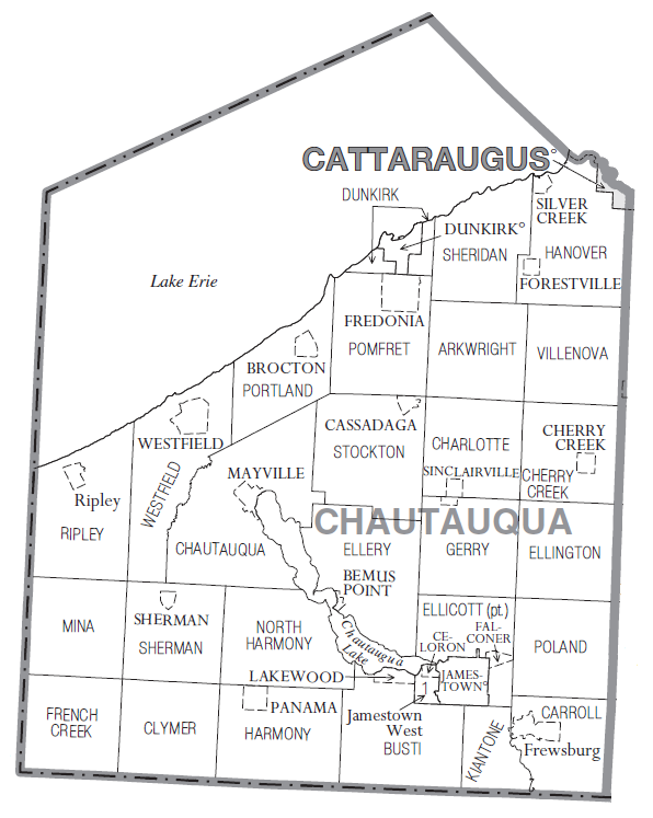
Summary
| Description |
English: Map of Chautauqua County, NY showing cities, towns, villages and CDPs. Taken from U.S. Census Bureau website and modified by Reelcheeper. |
| Date | |
| Source | http://www2.census.gov/geo/maps/general_ref/cousub_outline/cen2k_pgsz/ny_cosub.pdf |
| Author | U.S. Census Bureau |
Licensing
This image or file is a work of a United States Census Bureau employee, taken or made as part of that person's official duties. As a work of the U.S. federal government, the image is in the public domain.
|
 |
File history
Click on a date/time to view the file as it appeared at that time.
| Date/Time | Thumbnail | Dimensions | User | Comment | |
|---|---|---|---|---|---|
| current | 15:17, 21 July 2011 | | 596 × 747 (130 KB) | Reelcheeper | uploaded a narrower version of the image (it will fit better into Wikipedia articles) |
| 22:15, 20 July 2011 |  | 748 × 747 (103 KB) | Reelcheeper |
File usage
The following pages on the English Wikipedia use this file (pages on other projects are not listed):
Global file usage
The following other wikis use this file:
- Usage on ja.wikipedia.org
- Usage on ku.wikipedia.org
- Usage on nl.wikipedia.org
- Usage on pt.wikipedia.org