
File:Charlotte amalie airport diagram.jpg
Size of this preview: 393 × 599 pixels. Other resolutions: 157 × 240 pixels | 315 × 480 pixels | 504 × 768 pixels | 1,205 × 1,837 pixels.
Original file (1,205 × 1,837 pixels, file size: 390 KB, MIME type: image/jpeg)
| This is a file from the Wikimedia Commons. Information from its description page there is shown below. Commons is a freely licensed media file repository. You can help. |
Summary
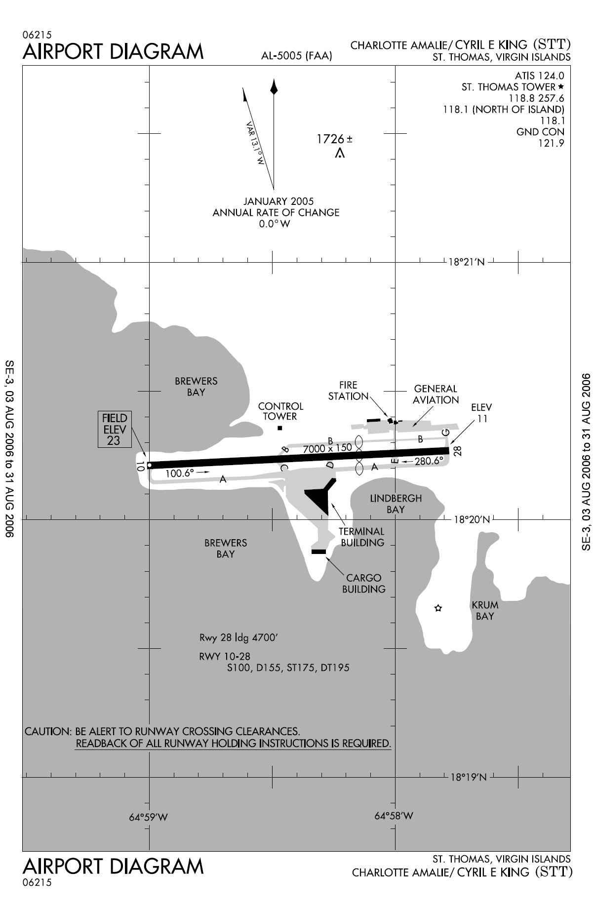
| Description | FAA diagram for Cyril E. King Airport (FAA: STT, ICAO: TIST) in Charlotte Amalie, Saint Thomas, U.S. Virgin Islands. |
| Date | 13 August 2006 |
| Source | http://naco.faa.gov/d-tpp/0608/05005AD.PDF (effective 03 AUG 2006 to 31 AUG 2006). Note: this URL changes monthly, see airport article's external links for a link to the current FAA diagram. |
| Author | National Aeronautical Charting Office (NACO), a department of the Federal Aviation Administration (FAA) in the United States. |
| Permission (Reusing this file) |
Public Domain |
Licensing
This image or file is a work of a Federal Aviation Administration employee, taken or made as part of that person's official duties. As a work of the U.S. federal government, the image is in the public domain in the United States.
|
 |
en:Cyril E. King Airport de:Cyril E. King Airport no:Cyril E. King Airport
File history
Click on a date/time to view the file as it appeared at that time.
| Date/Time | Thumbnail | Dimensions | User | Comment | |
|---|---|---|---|---|---|
| current | 11:10, 13 August 2006 | | 1,205 × 1,837 (390 KB) | Co-flens~commonswiki | {{Information |Description=Cyril E. King Airport, island of St. Thomas, United States Virgin Islands. |Source= |Date= |Author= |Permission= |other_versions= }} |
File usage
The following pages on the English Wikipedia use this file (pages on other projects are not listed):
Global file usage
The following other wikis use this file:
- Usage on de.wikipedia.org
- Usage on es.wikipedia.org
- Usage on fa.wikipedia.org
- Usage on no.wikipedia.org
- Usage on tg.wikipedia.org