
File:Cerist 'station' probable site geograph-3104546-by-Ben-Brooksbank.jpg
Size of this preview: 800 × 458 pixels. Other resolutions: 320 × 183 pixels | 640 × 366 pixels | 1,024 × 586 pixels | 1,280 × 733 pixels | 2,365 × 1,354 pixels.
Original file (2,365 × 1,354 pixels, file size: 2.36 MB, MIME type: image/jpeg)
| This is a file from the Wikimedia Commons. Information from its description page there is shown below. Commons is a freely licensed media file repository. You can help. |
Summary
| Description |
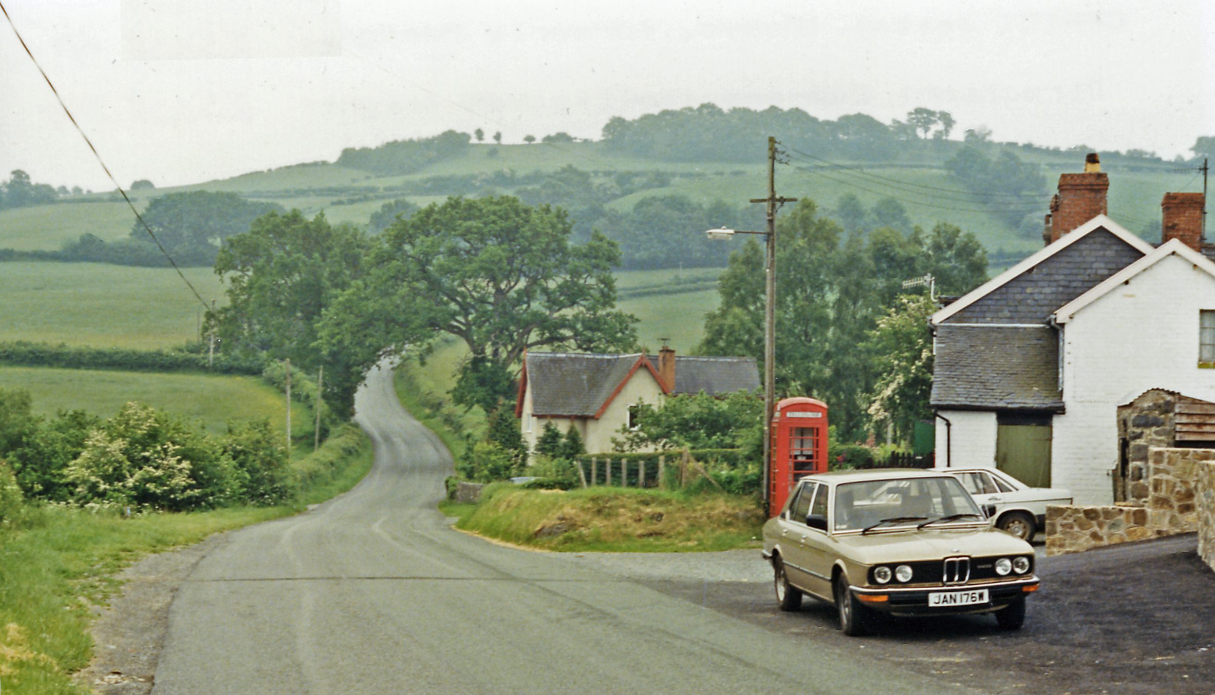
English: Probable site of Cerist 'station' on Van Railway, 1986. View southward across Afon Cerist valley to Cern Carnedd (908 ft.). From August 1871 until finally closed in November 1940, a mineral railway ran from Caersws (to left) to Van (to right). Until about 1879 (!), it conveyed passengers a Halt of sorts existed her at Cerist. (My more modern transport features outside the Post Office). |
| Date | |
| Source | From geograph.org.uk |
| Author | Ben Brooksbank |
| Permission (Reusing this file) |
Creative Commons Attribution Share-alike license 2.0 |
| Attribution (required by the license) | Ben Brooksbank / Probable site of Cerist 'station' on Van Railway, 1986 / |
| Camera location | | View this and other nearby images on: OpenStreetMap |
|---|
Licensing

|
This image was taken from the Geograph project collection. See this photograph's page on the Geograph website for the photographer's contact details. The copyright on this image is owned by Ben Brooksbank and is licensed for reuse under the Creative Commons Attribution-ShareAlike 2.0 license.
|
This file is licensed under the Creative Commons Attribution-Share Alike 2.0 Generic license.
Attribution: Ben Brooksbank
- You are free:
- to share – to copy, distribute and transmit the work
- to remix – to adapt the work
- Under the following conditions:
- attribution – You must give appropriate credit, provide a link to the license, and indicate if changes were made. You may do so in any reasonable manner, but not in any way that suggests the licensor endorses you or your use.
- share alike – If you remix, transform, or build upon the material, you must distribute your contributions under the same or compatible license as the original.
File history
Click on a date/time to view the file as it appeared at that time.
| Date/Time | Thumbnail | Dimensions | User | Comment | |
|---|---|---|---|---|---|
| current | 11:52, 2 September 2012 | | 2,365 × 1,354 (2.36 MB) | Chevin | == {{int:filedesc}} == {{Information |Description={{en|1='''Probable site of Cerist 'station' on Van Railway, 1986.'''<br/> View southward across Afon Cerist valley to Cern Carnedd (908 ft.). From August 1871 until finally closed in November 1940, a mi... |
File usage
The following pages on the English Wikipedia use this file (pages on other projects are not listed):