
File:Central Coast wards map.svg

Size of this PNG preview of this SVG file: 800 × 523 pixels. Other resolutions: 320 × 209 pixels | 640 × 418 pixels | 1,024 × 670 pixels | 1,280 × 837 pixels | 2,560 × 1,674 pixels | 1,719 × 1,124 pixels.
Original file (SVG file, nominally 1,719 × 1,124 pixels, file size: 91 KB)
| This is a file from the Wikimedia Commons. Information from its description page there is shown below. Commons is a freely licensed media file repository. You can help. |
Summary
| Description |
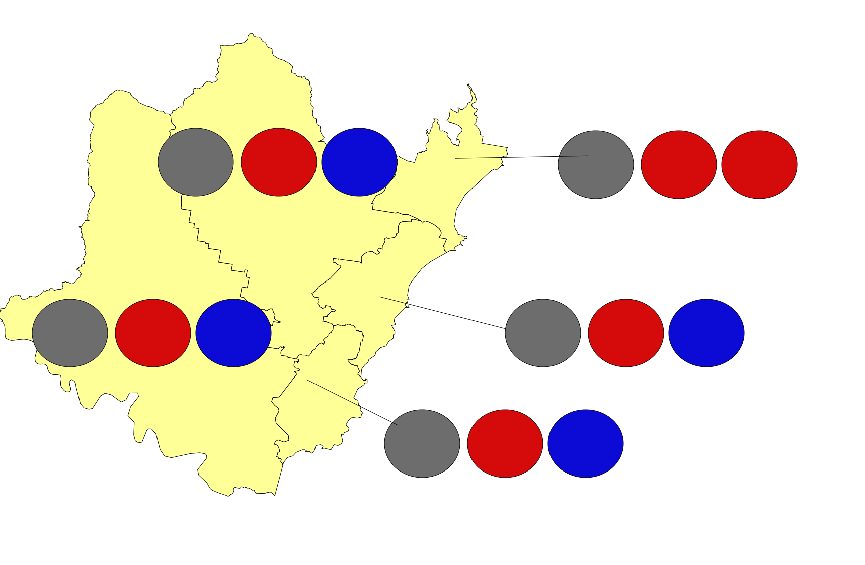
English: A map showing the five wards of the Central Coast Council, a local government area (LGA) on the Central Coast, with circles showing the number of seats held by each party in each ward (red is Labor, blue is Liberal and grey is independents). The five wards are: Budgewoi, Gosford East, Gosford West, The Entrance and Wyong. |
| Date | |
| Source | Own work |
| Author | QLDer in NSW |
Licensing
I, the copyright holder of this work, hereby publish it under the following license:
This file is licensed under the Creative Commons Attribution-Share Alike 4.0 International license.
- You are free:
- to share – to copy, distribute and transmit the work
- to remix – to adapt the work
- Under the following conditions:
- attribution – You must give appropriate credit, provide a link to the license, and indicate if changes were made. You may do so in any reasonable manner, but not in any way that suggests the licensor endorses you or your use.
- share alike – If you remix, transform, or build upon the material, you must distribute your contributions under the same or compatible license as the original.
File history
Click on a date/time to view the file as it appeared at that time.
| Date/Time | Thumbnail | Dimensions | User | Comment | |
|---|---|---|---|---|---|
| current | 01:48, 19 August 2023 | | 1,719 × 1,124 (91 KB) | QLDer in NSW | Uploaded own work with UploadWizard |
File usage
The following pages on the English Wikipedia use this file (pages on other projects are not listed):