
File:Cedar Hills sign.jpg
Size of this preview: 401 × 599 pixels. Other resolutions: 160 × 240 pixels | 321 × 480 pixels | 514 × 768 pixels | 685 × 1,024 pixels | 1,454 × 2,173 pixels.
Original file (1,454 × 2,173 pixels, file size: 770 KB, MIME type: image/jpeg)
| This is a file from the Wikimedia Commons. Information from its description page there is shown below. Commons is a freely licensed media file repository. You can help. |
Summary
| Description |
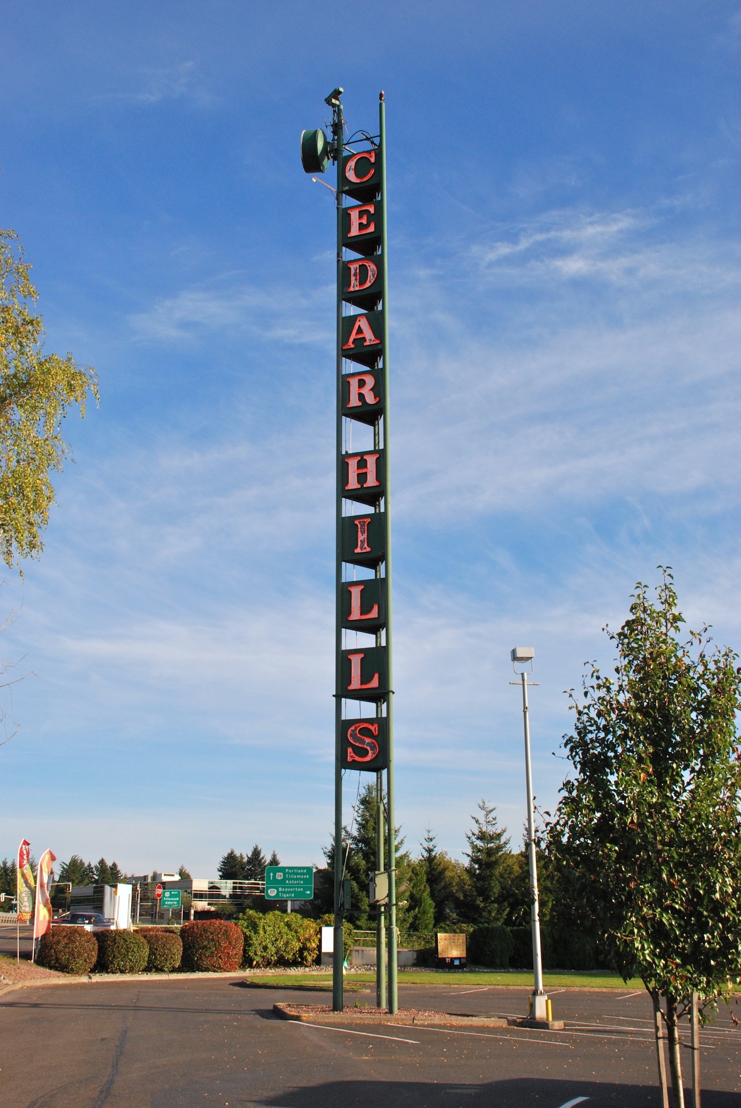
English: The tall, neon "Cedar Hills" sign, a local landmark – in place since the 1950s and visible from the nearby Sunset Highway (freeway). It is located in the parking lot of the Cedar Hills Shopping Center, which opened in 1955 and is located immediately southwest of the interchange of the Sunset Highway and Oregon Highway 217 freeways. Most of Cedar Hills remains unincorporated in 2022, but the Cedar Hills Shopping Center property was annexed by the city of Beaverton in the late 2010s. |
| Date | |
| Source | Own work |
| Author | Steve Morgan |
| Permission (Reusing this file) |
See below; attribute the photographer (Steve Morgan) on any reuse outside Wikipedia. |
| Camera location | | View this and other nearby images on: OpenStreetMap |
|---|
Licensing
I, the copyright holder of this work, hereby publish it under the following licenses:
This file is licensed under the Creative Commons Attribution-Share Alike 3.0 Unported license.
- You are free:
- to share – to copy, distribute and transmit the work
- to remix – to adapt the work
- Under the following conditions:
- attribution – You must give appropriate credit, provide a link to the license, and indicate if changes were made. You may do so in any reasonable manner, but not in any way that suggests the licensor endorses you or your use.
- share alike – If you remix, transform, or build upon the material, you must distribute your contributions under the same or compatible license as the original.

|
Permission is granted to copy, distribute and/or modify this document under the terms of the GNU Free Documentation License, Version 1.2 or any later version published by the Free Software Foundation; with no Invariant Sections, no Front-Cover Texts, and no Back-Cover Texts. A copy of the license is included in the section entitled GNU Free Documentation License. |
You may select the license of your choice.
File history
Click on a date/time to view the file as it appeared at that time.
| Date/Time | Thumbnail | Dimensions | User | Comment | |
|---|---|---|---|---|---|
| current | 12:03, 10 July 2011 | | 1,454 × 2,173 (770 KB) | Steve Morgan | {{Information |Description ={{en|1=The tall, neon "Cedar Hills" sign, a local landmark – in place since the 1950s and visible from the nearby Sunset Highway (freeway). It is located in the p |
File usage
The following pages on the English Wikipedia use this file (pages on other projects are not listed):
Global file usage
The following other wikis use this file:
- Usage on hu.wikipedia.org
- Usage on hy.wikipedia.org