
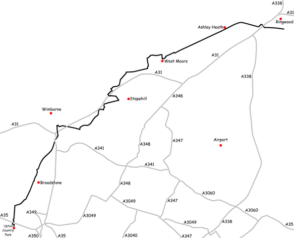
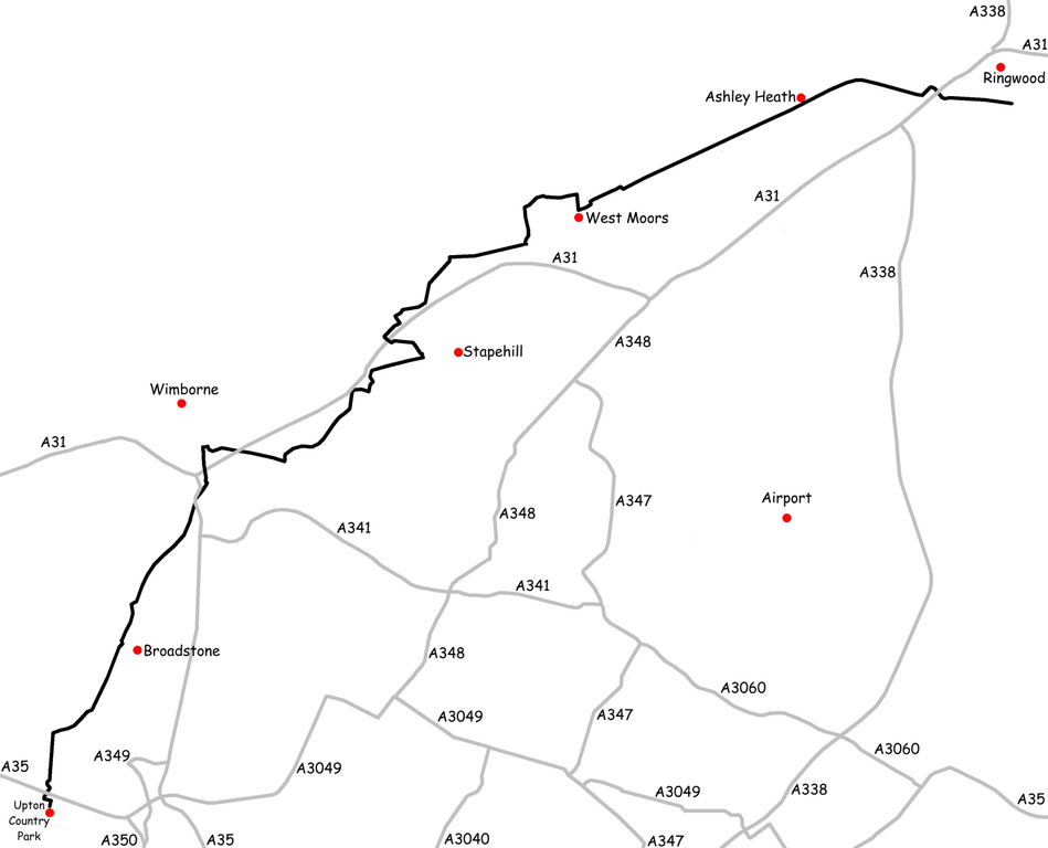
File:Castleman Trailway Map.png

Size of this preview: 741 × 600 pixels. Other resolutions: 297 × 240 pixels | 593 × 480 pixels | 949 × 768 pixels | 1,265 × 1,024 pixels | 1,482 × 1,200 pixels.
Original file (1,482 × 1,200 pixels, file size: 177 KB, MIME type: image/png)
| This is a file from the Wikimedia Commons. Information from its description page there is shown below. Commons is a freely licensed media file repository. You can help. |
Summary
| Description |
English: Created by Nick Austin and released to public domain on 11th March 2007.
Derived from GPS data; roads mapped by GPS between years 2001 and 2003; Trailway mapped by GPS in 2006. Uploaded for includion in article titled w:Castleman Trailway. |
| Date | |
| Source | Own work |
| Author | Nick1nildram (talk) (Uploads) |
Licensing
| I, the copyright holder of this work, release this work into the public domain. This applies worldwide. In some countries this may not be legally possible; if so: I grant anyone the right to use this work for any purpose, without any conditions, unless such conditions are required by law. |
File history
Click on a date/time to view the file as it appeared at that time.
| Date/Time | Thumbnail | Dimensions | User | Comment | |
|---|---|---|---|---|---|
| current | 12:55, 11 March 2007 | | 1,482 × 1,200 (177 KB) | Nick1nildram | Created by Nick Austin and released to public domain on 11th March 2007. Derived from GPS data; roads mapped by GPS between years 2001 and 2003; Trailway mapped by GPS in 2006. Uploaded for includion in article titled Castleman Trailway. |
File usage
The following pages on the English Wikipedia use this file (pages on other projects are not listed):