
File:Castle Douglas station site geograph-3103016-by-Ben-Brooksbank.jpg
Size of this preview: 800 × 467 pixels. Other resolutions: 320 × 187 pixels | 640 × 374 pixels | 1,024 × 598 pixels | 1,280 × 748 pixels | 2,354 × 1,375 pixels.
Original file (2,354 × 1,375 pixels, file size: 2.68 MB, MIME type: image/jpeg)
| This is a file from the Wikimedia Commons. Information from its description page there is shown below. Commons is a freely licensed media file repository. You can help. |
Summary
| Description |
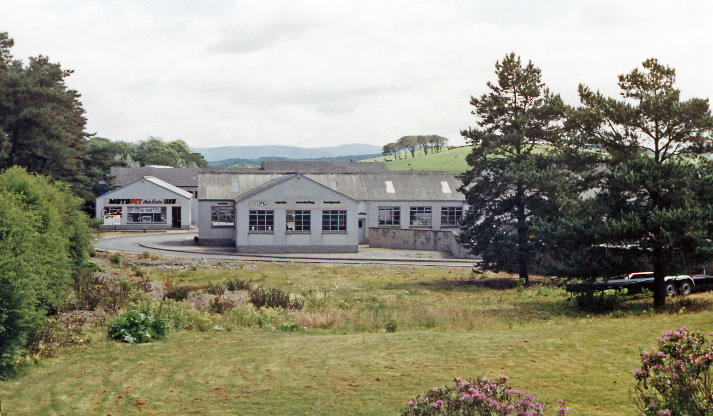
English: Site of Castle Douglas station, 1986. View eastward, towards Dumfries: ex-G&SW main line from Dumfries and Carlisle, joint with the Caledonian Railway on to Stranraer, also the junction for Kirkcudbright. Nothing original seemed to be visible in 1986, the station having been closed since 14/6/65 when the whole line between Dumfries and east of Stranraer at Challoch Junction - where the line from Ayr joined, was closed; the Kirkcudbright branch having succumbed on 3/5/65. |
| Date | |
| Source | From geograph.org.uk |
| Author | Ben Brooksbank |
| Permission (Reusing this file) |
Creative Commons Attribution Share-alike license 2.0 |
| Attribution (required by the license) | Ben Brooksbank / Site of Castle Douglas station, 1986 / |
| Camera location | | View this and other nearby images on: OpenStreetMap |
|---|
Licensing

|
This image was taken from the Geograph project collection. See this photograph's page on the Geograph website for the photographer's contact details. The copyright on this image is owned by Ben Brooksbank and is licensed for reuse under the Creative Commons Attribution-ShareAlike 2.0 license.
|
This file is licensed under the Creative Commons Attribution-Share Alike 2.0 Generic license.
Attribution: Ben Brooksbank
- You are free:
- to share – to copy, distribute and transmit the work
- to remix – to adapt the work
- Under the following conditions:
- attribution – You must give appropriate credit, provide a link to the license, and indicate if changes were made. You may do so in any reasonable manner, but not in any way that suggests the licensor endorses you or your use.
- share alike – If you remix, transform, or build upon the material, you must distribute your contributions under the same or compatible license as the original.
File history
Click on a date/time to view the file as it appeared at that time.
| Date/Time | Thumbnail | Dimensions | User | Comment | |
|---|---|---|---|---|---|
| current | 09:20, 2 September 2012 | | 2,354 × 1,375 (2.68 MB) | Chevin | == {{int:filedesc}} == {{Information |Description={{en|1='''Site of Castle Douglas station, 1986.'''<br/> View eastward, towards Dumfries: ex-G&SW main line from Dumfries and Carlisle, joint with the Caledonian Railway on to Stranraer, also the junctio... |
File usage
The following pages on the English Wikipedia use this file (pages on other projects are not listed):
Global file usage
The following other wikis use this file:
- Usage on www.wikidata.org