
File:Carn Menyn bluestones - geograph.org.uk - 1451509.jpg
No higher resolution available.
Carn_Menyn_bluestones_-_geograph.org.uk_-_1451509.jpg (640 × 480 pixels, file size: 83 KB, MIME type: image/jpeg)
| This is a file from the Wikimedia Commons. Information from its description page there is shown below. Commons is a freely licensed media file repository. You can help. |
Summary
| Description |
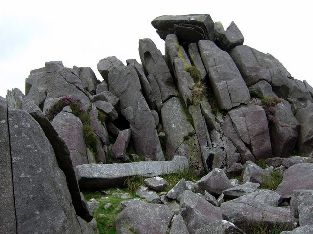
English: Carn Menyn bluestones. These dolerite slabs, split by frost action, seem to be stacked ready for the taking and many have been removed over the centuries for use locally but it remains a moot point whether the Stonehenge bluestones were conveyed thence by human or glacial means. Supporters of the former hypothesis suggest that the horizontal slab at the foot of the crag was selected and prepared for Stonehenge but in the event not needed. More recently stones have been removed for a variety of purposes for example 1042547. |
| Date | |
| Source | From geograph.org.uk |
| Author | ceridwen |
| Attribution (required by the license) | ceridwen / Carn Menyn bluestones / |
| Camera location | | View this and other nearby images on: OpenStreetMap |
|---|
_heading:0.00&language=en)
| Object location | | View this and other nearby images on: OpenStreetMap |
|---|
_heading:0.00&language=en)
Licensing

|
This image was taken from the Geograph project collection. See this photograph's page on the Geograph website for the photographer's contact details. The copyright on this image is owned by ceridwen and is licensed for reuse under the Creative Commons Attribution-ShareAlike 2.0 license.
|
This file is licensed under the Creative Commons Attribution-Share Alike 2.0 Generic license.
Attribution: ceridwen
- You are free:
- to share – to copy, distribute and transmit the work
- to remix – to adapt the work
- Under the following conditions:
- attribution – You must give appropriate credit, provide a link to the license, and indicate if changes were made. You may do so in any reasonable manner, but not in any way that suggests the licensor endorses you or your use.
- share alike – If you remix, transform, or build upon the material, you must distribute your contributions under the same or compatible license as the original.
File history
Click on a date/time to view the file as it appeared at that time.
| Date/Time | Thumbnail | Dimensions | User | Comment | |
|---|---|---|---|---|---|
| current | 04:49, 2 March 2011 | | 640 × 480 (83 KB) | GeographBot | == {{int:filedesc}} == {{Information |description={{en|1=Carn Menyn bluestones These dolerite slabs, split by frost action, seem to be stacked ready for the taking and many have been removed over the centuries for use locally but it remains a moot point w |
File usage
The following pages on the English Wikipedia use this file (pages on other projects are not listed):
Global file usage
The following other wikis use this file:
- Usage on de.wikipedia.org
- Usage on en.wiktionary.org
- Usage on fa.wikipedia.org
- Usage on fr.wikipedia.org