
File:Canal system in Lowell, Massachusetts.jpg

Size of this preview: 800 × 531 pixels. Other resolutions: 320 × 212 pixels | 640 × 425 pixels | 1,024 × 680 pixels | 1,280 × 850 pixels | 2,560 × 1,700 pixels | 6,688 × 4,441 pixels.
Original file (6,688 × 4,441 pixels, file size: 5.5 MB, MIME type: image/jpeg)
| This is a file from the Wikimedia Commons. Information from its description page there is shown below. Commons is a freely licensed media file repository. You can help. |

|
This file has been superseded by 1975 map of canal system in Lowell, Massachusetts.png. It is recommended to use the other file. Please note that deleting superseded images requires consent. Reason to use the other file: "A PNG version of this file is now available."
|

|
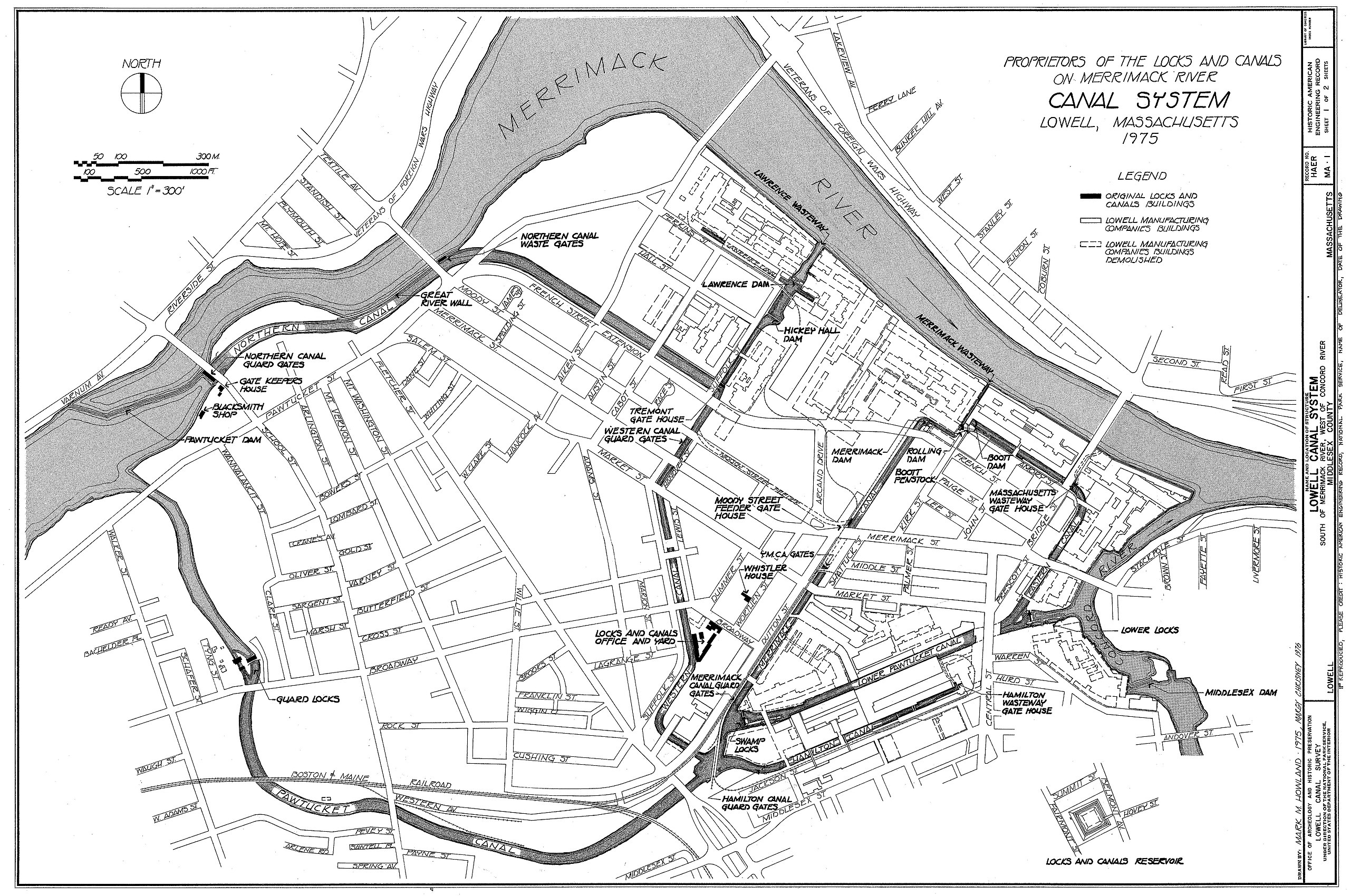
| Description | Canal system in Lowell, Massachusetts. Map as of 1975. | ||||
| Date | |||||
| Source |
Lowell Canal System, Merrimack & Concord Rivers, Lowell, Middlesex County, MA, Historic American Engineering Record (Library of Congress), drawing 1. Image cropped to remove white space
|
||||
| Author | Mark M. Howland, Margy Chrisney | ||||
| Permission (Reusing this file) |
|

File history
Click on a date/time to view the file as it appeared at that time.
| Date/Time | Thumbnail | Dimensions | User | Comment | |
|---|---|---|---|---|---|
| current | 00:25, 18 December 2006 | | 6,688 × 4,441 (5.5 MB) | Daderot | {{Information |Description=Canal system in Lowell, Massachusetts. Map as of 1975. |Source=Lowell Canal System, Merrimack & Concord Rivers, Lowell, Middlesex County, MA, Historic American Engineering Record (Library of Congress), http://hdl.loc.gov/loc.pnp |
File usage
The following pages on the English Wikipedia use this file (pages on other projects are not listed):
Global file usage
The following other wikis use this file:
- Usage on de.wikipedia.org
- Usage on es.wikipedia.org
- Usage on fr.wikipedia.org
- Usage on new.wikipedia.org
- Usage on vi.wikipedia.org