
File:CD-001a-Tablette de Ga-Sur.jpg
Size of this preview: 739 × 600 pixels. Other resolutions: 296 × 240 pixels | 592 × 480 pixels | 947 × 768 pixels | 1,262 × 1,024 pixels | 2,475 × 2,008 pixels.
Original file (2,475 × 2,008 pixels, file size: 239 KB, MIME type: image/jpeg)
| This is a file from the Wikimedia Commons. Information from its description page there is shown below. Commons is a freely licensed media file repository. You can help. |
Summary
| Description |
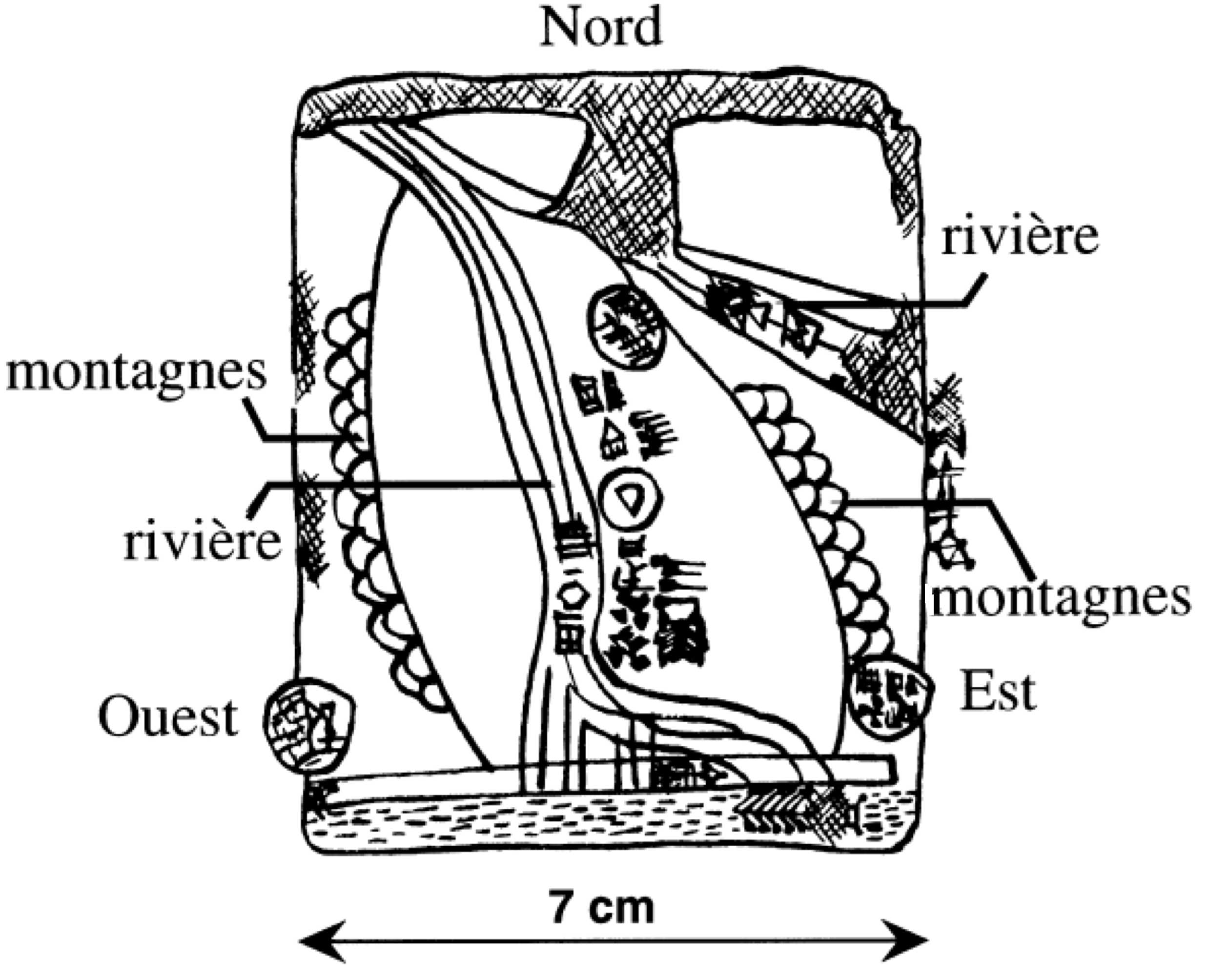
Français : Esquisse explicative de la plus ancienne carte géographique connue. La carte figure sur une tablette d'argile sumérienne provenant des fouilles de Ga-Sur à Nuzi (Irak). La tablette est datée de 2500 avant notre ère et est conservée au Musée Sémitique de l'Université de Harvard à Cambridge (Massachusetts, EUA). |
| Date | 19 July 2006 (original upload date) |
| Source | L'esquisse en elle-même est l'œuvre de Carlo Denis, auteur de l'article sous sa forme originale, qui la met dans le domaine public. Par conséquent, elle peut être copiée, transformée et diffusée librement. Carlo denis 19 juillet 2006 à 11:36 (CEST) |
| Author | Original uploader was Carlo denis at French Wikipedia |
| Permission (Reusing this file) |
Released under the GNU Free Documentation License. |
Licensing

|
Permission is granted to copy, distribute and/or modify this document under the terms of the GNU Free Documentation License, Version 1.2 or any later version published by the Free Software Foundation; with no Invariant Sections, no Front-Cover Texts, and no Back-Cover Texts. A copy of the license is included in the section entitled GNU Free Documentation License. |
| This file is licensed under the Creative Commons Attribution-Share Alike 3.0 Unported license. | ||
| ||
| This licensing tag was added to this file as part of the GFDL licensing update. |
Original upload log
Transferred from fr.wikipedia to Commons by Bloody-libu using CommonsHelper.
The original description page was here. All following user names refer to fr.wikipedia.
- 2006-07-19 09:36 Carlo denis 2475×2008× (244399 bytes) Esquisse explicative de la plus ancienne carte géographique connue. La carte figure sur une tablette d'argile sumérienne provenant des fouilles de Ga-Sur à Nuzi (Irak). La tablette est datée de 2500 avant notre ère et est conservée au Musée Sémiti
File history
Click on a date/time to view the file as it appeared at that time.
| Date/Time | Thumbnail | Dimensions | User | Comment | |
|---|---|---|---|---|---|
| current | 18:20, 16 August 2012 | | 2,475 × 2,008 (239 KB) | File Upload Bot (Magnus Manske) | Transfered from fr.wikipedia by User:Bloody-libu using CommonsHelper |
File usage
The following pages on the English Wikipedia use this file (pages on other projects are not listed):
Global file usage
The following other wikis use this file:
- Usage on es.wikipedia.org
- Usage on fa.wikipedia.org
- Usage on fr.wikipedia.org
- Usage on pl.wikipedia.org