
File:Bundesautobahn 7 map.png

Size of this preview: 444 × 600 pixels. Other resolutions: 178 × 240 pixels | 355 × 480 pixels | 569 × 768 pixels | 1,122 × 1,515 pixels.
Original file (1,122 × 1,515 pixels, file size: 206 KB, MIME type: image/png)
| This is a file from the Wikimedia Commons. Information from its description page there is shown below. Commons is a freely licensed media file repository. You can help. |
Summary
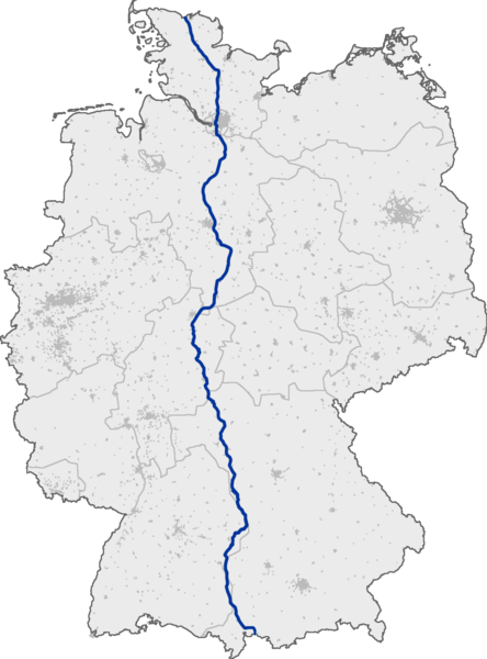
Deutsch: Verlauf der Bundesautobahn 7 in Deutschland
English: Bundesautobahn 7 in Germany
Licensing
This image was generated with OpenGeoDB. The information there is placed in the public domain, images generated from OpenGeoDB are derivative works without passing the threshold of creativity, they are therefore also public domain.
| This work is ineligible for copyright and therefore in the public domain because it consists entirely of information that is common property and contains no original authorship. |
File history
Click on a date/time to view the file as it appeared at that time.
| Date/Time | Thumbnail | Dimensions | User | Comment | |
|---|---|---|---|---|---|
| current | 16:48, 2 December 2010 | | 1,122 × 1,515 (206 KB) | Stefan040780 | |
| 09:09, 13 September 2005 |  | 1,122 × 1,515 (88 KB) | Qualle | Bundesautobahn 7 in Germany 007 |
File usage
The following pages on the English Wikipedia use this file (pages on other projects are not listed):
Global file usage
The following other wikis use this file:
- Usage on cs.wikipedia.org
- Usage on da.wikipedia.org
- Usage on de.wikipedia.org
- Usage on fi.wikipedia.org
- Usage on fr.wikipedia.org
- Usage on hr.wikipedia.org
- Usage on hu.wikipedia.org
- Usage on id.wikipedia.org
- Usage on ja.wikipedia.org
- Usage on ko.wikipedia.org
- Usage on no.wikipedia.org
- Usage on pt.wikipedia.org
- Usage on ru.wikipedia.org
- Usage on sk.wikipedia.org