
File:Buffalo Springs bridge and gazebo.jpg

Size of this preview: 800 × 532 pixels. Other resolutions: 320 × 213 pixels | 640 × 426 pixels | 1,024 × 681 pixels | 1,280 × 851 pixels | 2,560 × 1,702 pixels | 6,016 × 4,000 pixels.
Original file (6,016 × 4,000 pixels, file size: 6.48 MB, MIME type: image/jpeg)
| This is a file from the Wikimedia Commons. Information from its description page there is shown below. Commons is a freely licensed media file repository. You can help. |
|
This is an image of a place or building that is listed on the National Register of Historic Places in the United States of America. Its reference number is 98000603. |
| Camera location | | View this and other nearby images on: OpenStreetMap |
|---|
| Description |
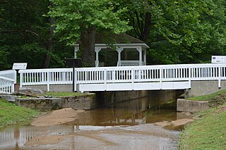
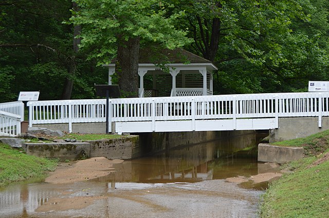
English: A bridge and gazebo along the Flat Rock Branch at Buffalo Springs, located just off U.S. Route 58 between Clarksville and South Boston in Mecklenburg County, Virginia, United States. Once a major lithia springs resort, the Buffalo Springs Historic District is now listed on the National Register of Historic Places as an archaeological site. |
||
| Date | Taken on 23 June 2018 | ||
| Source | Own work | ||
| Author | Nyttend | ||
| Permission (Reusing this file) |
|
||
| Other versions | None |
File history
Click on a date/time to view the file as it appeared at that time.
| Date/Time | Thumbnail | Dimensions | User | Comment | |
|---|---|---|---|---|---|
| current | 14:00, 20 September 2018 | | 6,016 × 4,000 (6.48 MB) | Nyttend |
File usage
The following pages on the English Wikipedia use this file (pages on other projects are not listed):
Global file usage
The following other wikis use this file:
- Usage on www.wikidata.org