
File:Brunswick Park Road - geograph.org.uk - 1512096.jpg
No higher resolution available.
Brunswick_Park_Road_-_geograph.org.uk_-_1512096.jpg (640 × 407 pixels, file size: 204 KB, MIME type: image/jpeg)
| This is a file from the Wikimedia Commons. Information from its description page there is shown below. Commons is a freely licensed media file repository. You can help. |
Summary
| Description |
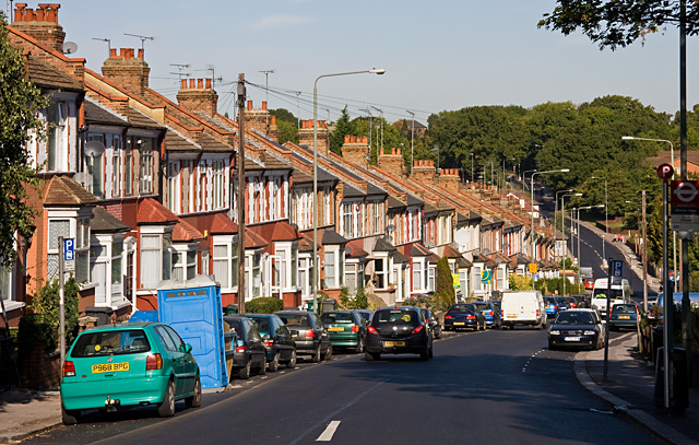
English: Brunswick Park Road The road descends into a valley that was probably created by a tributary of Pymmes Brook - the stream on the North Middlesex Golf Course seems a likely candidate.
At the bottom it passes New Southgate Recreation Ground before climbing again to a summit beside New Southgate Cemetery, hidden in the trees on the horizon. |
| Date | |
| Source | From geograph.org.uk |
| Author | Martin Addison |
| Attribution (required by the license) | Martin Addison / Brunswick Park Road / |
| Camera location | | View this and other nearby images on: OpenStreetMap |
|---|
_heading:337.00&language=en)
| Object location | | View this and other nearby images on: OpenStreetMap |
|---|
_heading:337.00&language=en)
Licensing

|
This image was taken from the Geograph project collection. See this photograph's page on the Geograph website for the photographer's contact details. The copyright on this image is owned by Martin Addison and is licensed for reuse under the Creative Commons Attribution-ShareAlike 2.0 license.
|
This file is licensed under the Creative Commons Attribution-Share Alike 2.0 Generic license.
Attribution: Martin Addison
- You are free:
- to share – to copy, distribute and transmit the work
- to remix – to adapt the work
- Under the following conditions:
- attribution – You must give appropriate credit, provide a link to the license, and indicate if changes were made. You may do so in any reasonable manner, but not in any way that suggests the licensor endorses you or your use.
- share alike – If you remix, transform, or build upon the material, you must distribute your contributions under the same or compatible license as the original.
File history
Click on a date/time to view the file as it appeared at that time.
| Date/Time | Thumbnail | Dimensions | User | Comment | |
|---|---|---|---|---|---|
| current | 23:33, 2 March 2011 | | 640 × 407 (204 KB) | GeographBot | == {{int:filedesc}} == {{Information |description={{en|1=Brunswick Park Road The road descends into a valley that was probably created by a tributary of Pymmes Brook - the stream on the North Middlesex Golf Course seems a likely candidate. At the botto |
File usage
The following pages on the English Wikipedia use this file (pages on other projects are not listed):
Global file usage
The following other wikis use this file:
- Usage on ga.wikipedia.org
- Usage on no.wikipedia.org
- Usage on www.wikidata.org