
File:British India 1940 Assam Bihar Sikkim Arunachal Pradesh Mizoram Nagaland Tripura Burma Bhutan Map.jpg

Size of this preview: 778 × 600 pixels. Other resolutions: 311 × 240 pixels | 623 × 480 pixels | 996 × 768 pixels | 1,280 × 987 pixels | 1,712 × 1,320 pixels.
Original file (1,712 × 1,320 pixels, file size: 587 KB, MIME type: image/jpeg)
| This is a file from the Wikimedia Commons. Information from its description page there is shown below. Commons is a freely licensed media file repository. You can help. |
| Description |
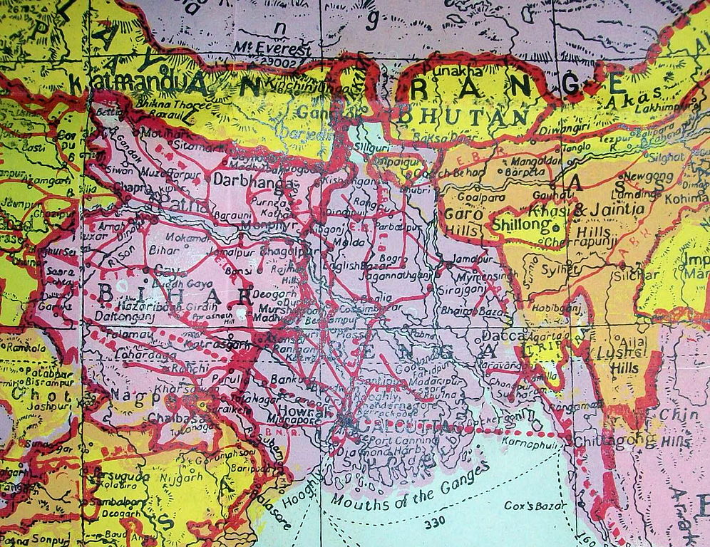
Map by Map House and the Indian Book Depot of Lahore. Pre-partition, dated June 1940. Bengal was still intact, and Sikkim was still a semi-independent Buddhist kingdom. |
||
| Date | |||
| Source | Flickr: British India 1940 | ||
| Author | davecito | ||
| Permission (Reusing this file) |
This file is licensed under the Creative Commons Attribution 2.0 Generic license.
|
File history
Click on a date/time to view the file as it appeared at that time.
| Date/Time | Thumbnail | Dimensions | User | Comment | |
|---|---|---|---|---|---|
| current | 18:24, 18 June 2014 | | 1,712 × 1,320 (587 KB) | Flickr upload bot | Uploaded from http://flickr.com/photo/23465812@N00/7980167450 using Flickr upload bot |
File usage
The following pages on the English Wikipedia use this file (pages on other projects are not listed):
Global file usage
The following other wikis use this file:
- Usage on ar.wikipedia.org
- Usage on bn.wikipedia.org
- Usage on hi.wikipedia.org
- Usage on kn.wikipedia.org
- Usage on lv.wikipedia.org
- Usage on my.wikipedia.org
- Usage on or.wikipedia.org
- Usage on pnb.wikipedia.org
- Usage on ta.wikipedia.org
- Usage on ur.wikipedia.org