
File:Bottenviken.png
No higher resolution available.
Bottenviken.png (316 × 380 pixels, file size: 12 KB, MIME type: image/png)
| This is a file from the Wikimedia Commons. Information from its description page there is shown below. Commons is a freely licensed media file repository. You can help. |

|
This locator map image could be re-created using vector graphics as an SVG file. This has several advantages; see Commons:Media for cleanup for more information. If an SVG form of this image is available, please upload it and afterwards replace this template with
{{vector version available|new image name}}.
It is recommended to name the SVG file “Bottenviken.svg”—then the template Vector version available (or Vva) does not need the new image name parameter. |
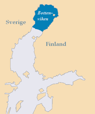
| Description |
Deutsch: Lage der Bottenwiek zwischen Schweden und Finnland
English: The Bothnian Bay between Sweden and Finland
Suomi: Perämeri
Svenska: Bottenviken |
||
| Date | |||
| Source | Own work | ||
| Author | MoRsE | ||
| Permission (Reusing this file) |
|
||
| Other versions | Derivative works of this file: Bottenvikenka.png |
File history
Click on a date/time to view the file as it appeared at that time.
| Date/Time | Thumbnail | Dimensions | User | Comment | |
|---|---|---|---|---|---|
| current | 17:55, 18 May 2013 | | 316 × 380 (12 KB) | Hasenläufer | cropped border |
| 18:47, 19 November 2006 |  | 320 × 384 (10 KB) | MoRsE | BOthnian Gulf {{PD-self}} --~~~~ |
File usage
The following pages on the English Wikipedia use this file (pages on other projects are not listed):
Global file usage
The following other wikis use this file:
- Usage on ar.wikipedia.org
- Usage on ast.wikipedia.org
- Usage on ca.wikipedia.org
- Usage on da.wikipedia.org
- Usage on de.wikipedia.org
- Usage on es.wikipedia.org
- Usage on et.wikipedia.org
- Usage on eu.wikipedia.org
- Usage on fr.wikipedia.org
- Usage on gl.wikipedia.org
- Usage on is.wikipedia.org
- Usage on ko.wikipedia.org
- Usage on nn.wikipedia.org
- Usage on pl.wikipedia.org
- Usage on pl.wiktionary.org
- Usage on pt.wikipedia.org
- Usage on simple.wikipedia.org
- Usage on sv.wikipedia.org
- Usage on tr.wikipedia.org
- Usage on uk.wikipedia.org
- Usage on ur.wikipedia.org
- Usage on war.wikipedia.org
- Usage on www.wikidata.org
- Usage on zh.wikipedia.org