
File:Bosanquet-topical.png
No higher resolution available.
Bosanquet-topical.png (361 × 411 pixels, file size: 9 KB, MIME type: image/png)
| This is a file from the Wikimedia Commons. Information from its description page there is shown below. Commons is a freely licensed media file repository. You can help. |
Summary
| Description |
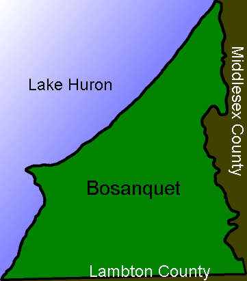
English: Simplified map of the political boundaries of the former township of Bosanquet, Ontario. |
| Source | Own work |
| Author | Brentgilliard |
Licensing
| This work has been released into the public domain by its author, Brentgilliard. This applies worldwide. In some countries this may not be legally possible; if so: |
| This image of simple geometry is ineligible for copyright and therefore in the public domain, because it consists entirely of information that is common property and contains no original authorship. |  |
Original upload log
Transferred from en.wikipedia to Commons using FtCG.
The original description page was here. All following user names refer to en.wikipedia.
| Date/Time | Dimensions | User | Comment |
|---|---|---|---|
| 2 July 2004, 22:36 | 361 × 411 (9,403 bytes) | w:en:Brentgilliard (talk | contribs) | ({{PD}} Created by self. Simplified map of the political boundaries of the former township of Bosanquet, Ontario.) |
File history
Click on a date/time to view the file as it appeared at that time.
| Date/Time | Thumbnail | Dimensions | User | Comment | |
|---|---|---|---|---|---|
| current | 13:54, 27 December 2011 | | 361 × 411 (9 KB) | Bulwersator | Transferred from en.wikipedia: see original upload log above |
File usage
The following pages on the English Wikipedia use this file (pages on other projects are not listed):