
File:Boone Trail marker in Sanford.jpg
Size of this preview: 398 × 599 pixels. Other resolutions: 159 × 240 pixels | 319 × 480 pixels | 510 × 768 pixels | 681 × 1,024 pixels | 1,362 × 2,048 pixels | 4,000 × 6,016 pixels.
Original file (4,000 × 6,016 pixels, file size: 6.26 MB, MIME type: image/jpeg)
| This is a file from the Wikimedia Commons. Information from its description page there is shown below. Commons is a freely licensed media file repository. You can help. |
| Camera location | | View this and other nearby images on: OpenStreetMap |
|---|
| Description |
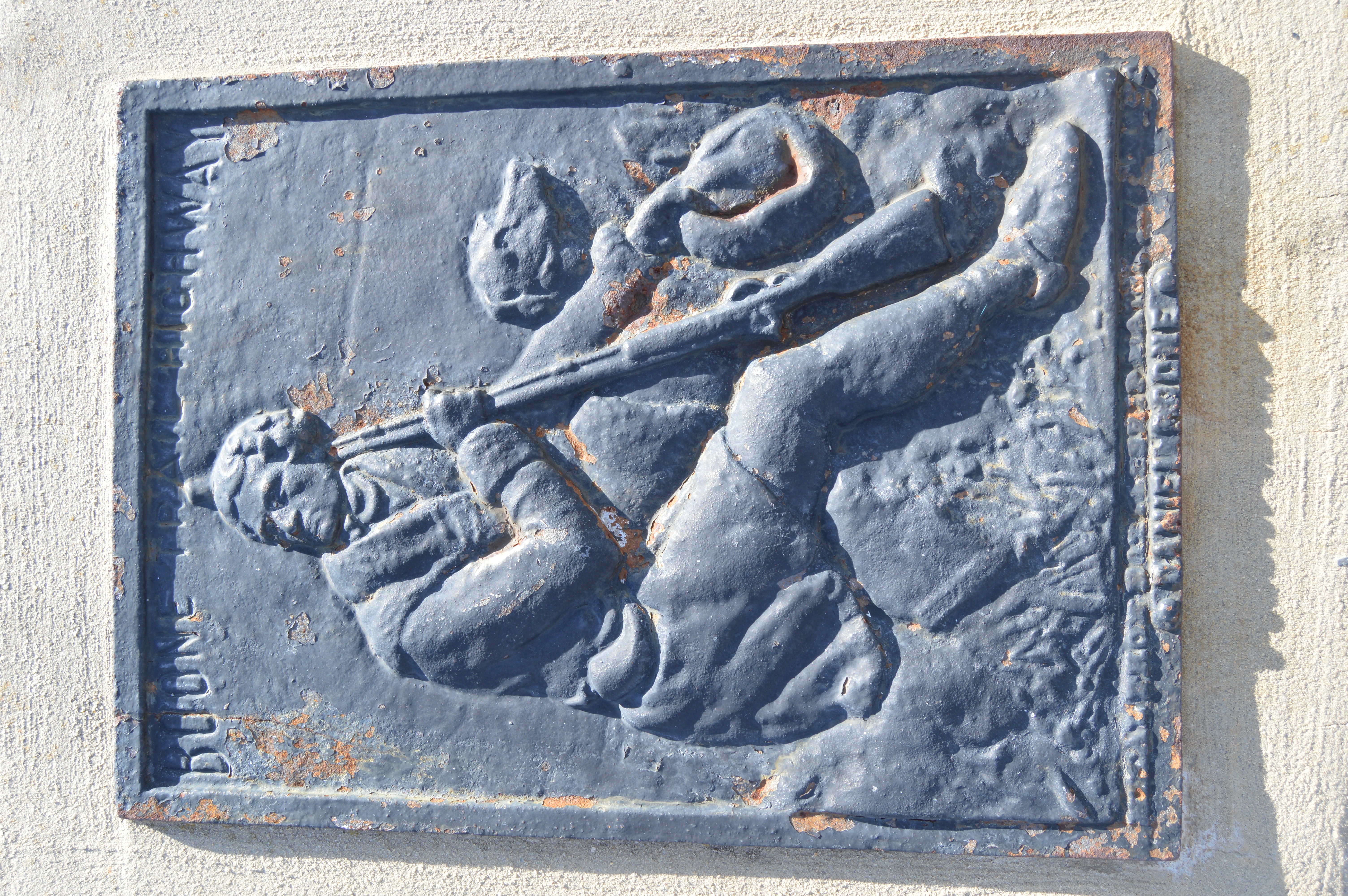
English: A surviving Boone Trail marker, located on Charlotte Avenue by the railroad crossing in downtown Sanford, North Carolina, United States. According to a nearby marker, this plaque was placed in 1927 and includes metal from USS Maine. |
|||||
| Date | Taken on 17 November 2017 | |||||
| Source | Own work | |||||
| Author | Nyttend | |||||
| Permission (Reusing this file) |
Photo and plaque respectively:
|
|||||
| Other versions | None |

File history
Click on a date/time to view the file as it appeared at that time.
| Date/Time | Thumbnail | Dimensions | User | Comment | |
|---|---|---|---|---|---|
| current | 05:41, 28 December 2017 | | 4,000 × 6,016 (6.26 MB) | Nyttend | {{Location|35|28|53.5|N|79|10|39.5|W}} {{Information |Description={{en|A surviving {{w|Boone Trail}} marker, located on Charlotte Avenue by the railroad crossing in downtown {{w|Sanford, North Carolina|Sanford}}, {{w|North Carolina}}, {{w|United States... |
File usage
The following pages on the English Wikipedia use this file (pages on other projects are not listed):