
File:Boise Greenbelt map.jpg
Size of this preview: 261 × 598 pixels. Other resolutions: 104 × 240 pixels | 209 × 480 pixels | 912 × 2,091 pixels.
Original file (912 × 2,091 pixels, file size: 999 KB, MIME type: image/jpeg)
| This is a file from the Wikimedia Commons. Information from its description page there is shown below. Commons is a freely licensed media file repository. You can help. |
Summary
| Description |
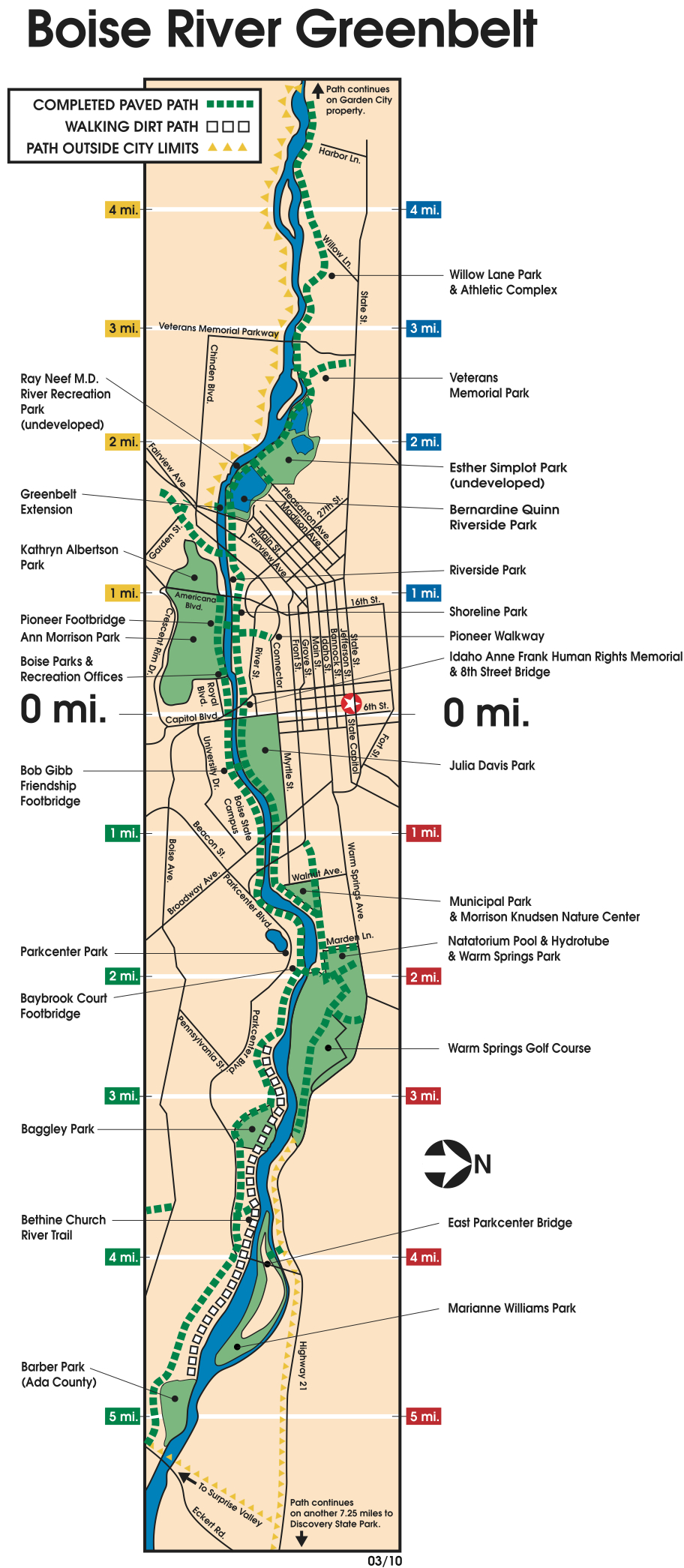
English: Boise River Greenbelt map |
| Source | http://www.cityofboise.org/Departments/Parks/PDF/ParksandFacilities/greenbelt_map.pdf |
| Author | City of Boise Idaho Parks and Recreation Department |
Licensing

|
The copyright holder of this file allows anyone to use it for any purpose, provided that the copyright holder is properly attributed. Redistribution, derivative work, commercial use, and all other use is permitted. |
|
|
File history
Click on a date/time to view the file as it appeared at that time.
| Date/Time | Thumbnail | Dimensions | User | Comment | |
|---|---|---|---|---|---|
| current | 00:36, 26 November 2018 | | 912 × 2,091 (999 KB) | Arlo Barnes | Cropped 42 % horizontally, 15 % vertically using CropTool with lossless mode. |
| 19:21, 8 December 2010 |  | 1,584 × 2,448 (1.03 MB) | Boisecynic | {{Information |Description={{en|1=Boise River Greenbelt map}} |Source=http://www.cityofboise.org/Departments/Parks/PDF/ParksandFacilities/greenbelt_map.pdf |Author=City of Boise Idaho Parks and Recreation Department |Date= |Permission= |other_versions= }} |
File usage
The following pages on the English Wikipedia use this file (pages on other projects are not listed):