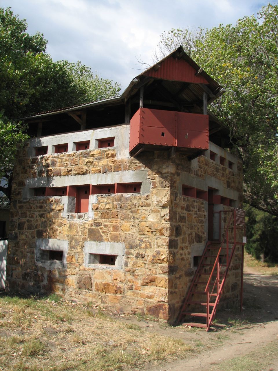
These Blockhouses were built in 1901 during the Anglo-Boer War. They were built by the British to protect the railway bridges from Boer attacks. The stone is local while the remaining materials were imported from Britain.
These Blockhouses could house 20 men with water, ammunition and supplies stored on the lower floor. The "living" area was the middle floor and was accessible by a retractable ladder and the top floor was the "look-out" deck.
Only 1000 of these Blockhouses were built and few have survived. They were very effective barriers and few saw any action.
to share – to copy, distribute and transmit the work
to remix – to adapt the work
Under the following conditions:
attribution – You must give appropriate credit, provide a link to the license, and indicate if changes were made. You may do so in any reasonable manner, but not in any way that suggests the licensor endorses you or your use.
https://creativecommons.org/licenses/by/2.0CC BY 2.0 Creative Commons Attribution 2.0 truetrue
This image, originally posted to Flickr, was reviewed on 11 May 2008 by the administrator or reviewerMifter, who confirmed that it was available on Flickr under the stated license on that date.
Captions
Blockhouse close to Wolseley, Western Cape dating from the Anlgo-Boer War (1899-1902)
{{Information |Description= These Blockhouses were built in 1901 during the Anglo-Boer War. They were built by the British to protect the railway bridges from Boer attacks. The stone is local while the remaining materials were imported from Britain. These
File usage
The following pages on the English Wikipedia use this file (pages on other projects are not listed):
