
File:Blackford County Indiana diagram V4.jpg
Size of this preview: 608 × 600 pixels. Other resolutions: 243 × 240 pixels | 487 × 480 pixels | 779 × 768 pixels | 1,038 × 1,024 pixels | 1,439 × 1,419 pixels.
Original file (1,439 × 1,419 pixels, file size: 197 KB, MIME type: image/jpeg)
| This is a file from the Wikimedia Commons. Information from its description page there is shown below. Commons is a freely licensed media file repository. You can help. |
Summary
| Description |
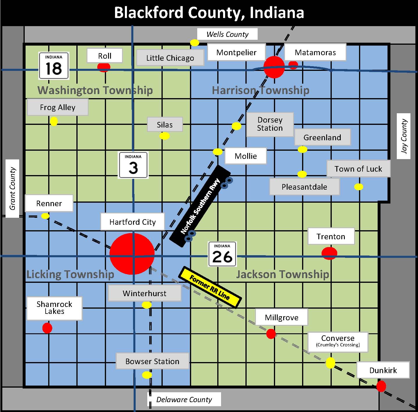
English: Map of Blackford County, Indiana, listing cities, towns, communities, and former communities |
| Date | |
| Source | Own work |
| Author | TwoScarsUp |
Map/diagram created in spreadsheet after consulting map on page 1 of Historic Landmarks Foundation of Indiana’s Blackford County: Interim Report, Indiana Historic Sites and Structures Inventory. Additional sources were Blackford County Historical Society's "Ghost Towns in Blackford County, Indiana", and a current road map of Northern Indiana produced by UniversalMAP. Rail line abandonment information from Surface Transportation Board archive copy at the Wayback Machine.
Licensing
I, the copyright holder of this work, hereby publish it under the following license:
| This file is made available under the Creative Commons CC0 1.0 Universal Public Domain Dedication. | |
| The person who associated a work with this deed has dedicated the work to the public domain by waiving all of their rights to the work worldwide under copyright law, including all related and neighboring rights, to the extent allowed by law. You can copy, modify, distribute and perform the work, even for commercial purposes, all without asking permission.
|
File history
Click on a date/time to view the file as it appeared at that time.
| Date/Time | Thumbnail | Dimensions | User | Comment | |
|---|---|---|---|---|---|
| current | 21:06, 17 December 2011 | | 1,439 × 1,419 (197 KB) | TwoScarsUp |
File usage
The following pages on the English Wikipedia use this file (pages on other projects are not listed):