
File:Bixby Creek Bridge 1932..jpg
Size of this preview: 800 × 449 pixels. Other resolutions: 320 × 180 pixels | 640 × 359 pixels | 1,024 × 575 pixels | 1,280 × 718 pixels | 2,860 × 1,605 pixels.
Original file (2,860 × 1,605 pixels, file size: 2.07 MB, MIME type: image/jpeg)
| This is a file from the Wikimedia Commons. Information from its description page there is shown below. Commons is a freely licensed media file repository. You can help. |
Summary
| Camera location | | View this and other nearby images on: OpenStreetMap |
|---|
| Description |
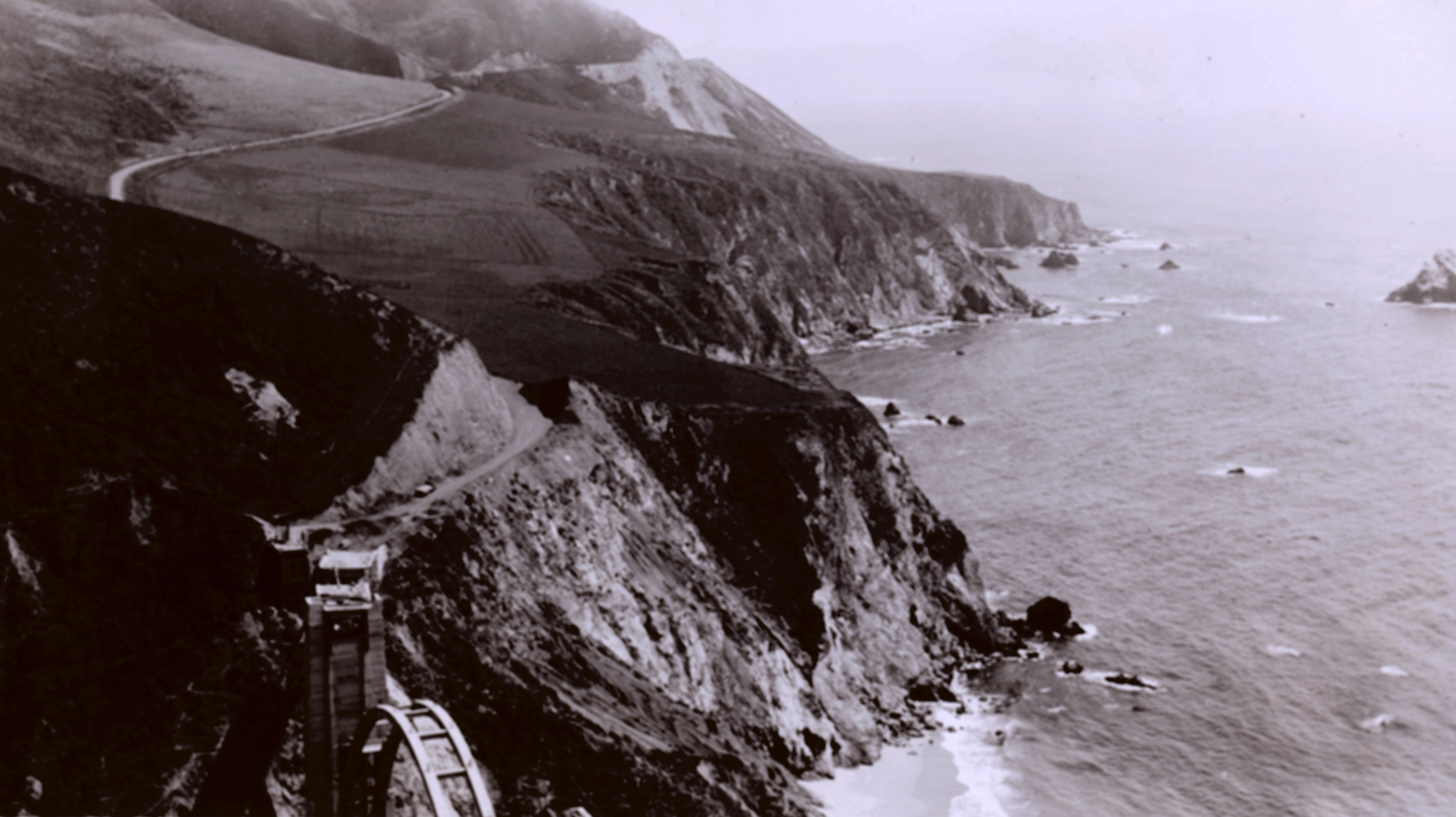
English: Bixby Canyon Bridge under construction on California Coast Highway 1. After completion, this bridge is now one of the most beautiful bridges in the United States. [original caption] |
| Date | |
| Source | http://www.photolib.noaa.gov/htmls/cgs00162.htm |
| Author | Floyd Risvold, United States Coast & Geodetic Survey |
Licensing
This image is in the public domain because it contains materials that originally came from the U.S. National Oceanic and Atmospheric Administration, taken or made as part of an employee's official duties.
|
File history
Click on a date/time to view the file as it appeared at that time.
| Date/Time | Thumbnail | Dimensions | User | Comment | |
|---|---|---|---|---|---|
| current | 17:46, 14 December 2011 | | 2,860 × 1,605 (2.07 MB) | Btphelps |
File usage
The following pages on the English Wikipedia use this file (pages on other projects are not listed):
Global file usage
The following other wikis use this file:
- Usage on pl.wikipedia.org
- Usage on zh.wikipedia.org