
File:Birch Vale 055401 56c02dad.jpg
No higher resolution available.
Birch_Vale_055401_56c02dad.jpg (640 × 480 pixels, file size: 149 KB, MIME type: image/jpeg)
| This is a file from the Wikimedia Commons. Information from its description page there is shown below. Commons is a freely licensed media file repository. You can help. |
Summary
| Description |
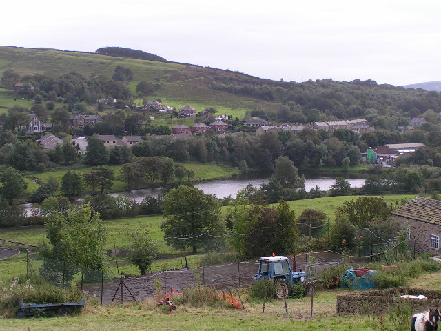
English: Birch Vale from Lower Cliff Viewpoint approx. SK026874. Looking SSW across the Sett valley, with the end of Hayfield Sewage Works just visible far left; in the centre is Birch Vale Reservoir and beyond that the houses of Birch Vale along the A6015. |
| Date | |
| Source | From geograph.org.uk |
| Author | Dave Dunford |
| Camera location | | View this and other nearby images on: OpenStreetMap |
|---|
Licensing

|
This image was taken from the Geograph project collection. See this photograph's page on the Geograph website for the photographer's contact details. The copyright on this image is owned by Dave Dunford and is licensed for reuse under the Creative Commons Attribution-ShareAlike 2.0 license.
|
This file is licensed under the Creative Commons Attribution-Share Alike 2.0 Generic license.
Attribution: Dave Dunford
- You are free:
- to share – to copy, distribute and transmit the work
- to remix – to adapt the work
- Under the following conditions:
- attribution – You must give appropriate credit, provide a link to the license, and indicate if changes were made. You may do so in any reasonable manner, but not in any way that suggests the licensor endorses you or your use.
- share alike – If you remix, transform, or build upon the material, you must distribute your contributions under the same or compatible license as the original.
File history
Click on a date/time to view the file as it appeared at that time.
| Date/Time | Thumbnail | Dimensions | User | Comment | |
|---|---|---|---|---|---|
| current | 15:54, 19 April 2008 | | 640 × 480 (149 KB) | Victuallers | {{Information |Description=Birch Vale is a village in Derbyshire. Birch Vale from Lower Cliff Viewpoint approx. SK026874. Looking SSW across the Sett valley, with the end of Hayfield Sewage Works just visible far left; in the centre is Bi |
File usage
The following pages on the English Wikipedia use this file (pages on other projects are not listed):
Global file usage
The following other wikis use this file:
- Usage on pl.wikipedia.org