
File:Barrier Islands LandSat.png
No higher resolution available.
Barrier_Islands_LandSat.png (477 × 590 pixels, file size: 287 KB, MIME type: image/png)
| This is a file from the Wikimedia Commons. Information from its description page there is shown below. Commons is a freely licensed media file repository. You can help. |
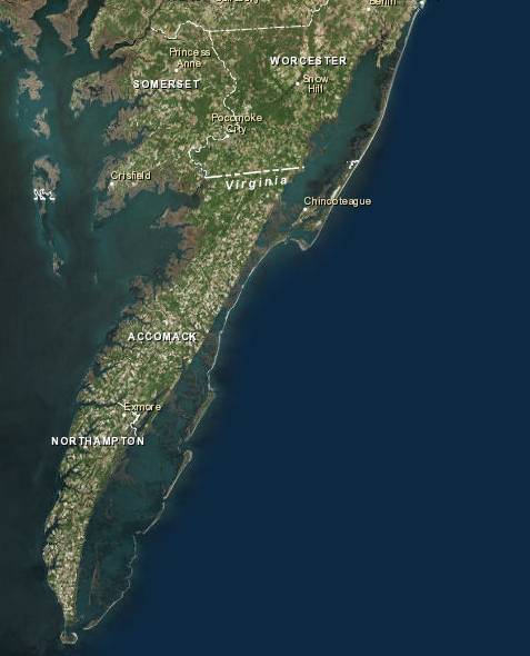
Summary
| Description |
English: Virginia Barrier Islands off the coast of Delmarva Peninsula |
| Date | |
| Source | NASA LandSat |
| Author | NASA |
Licensing
| This file is in the public domain in the United States because it was solely created by NASA. NASA copyright policy states that "NASA material is not protected by copyright unless noted". (See Template:PD-USGov, NASA copyright policy page or JPL Image Use Policy.) | ||
 |
Warnings:
|
File history
Click on a date/time to view the file as it appeared at that time.
| Date/Time | Thumbnail | Dimensions | User | Comment | |
|---|---|---|---|---|---|
| current | 06:31, 27 November 2014 | | 477 × 590 (287 KB) | Piledhighandeep | User created page with UploadWizard |
File usage
The following pages on the English Wikipedia use this file (pages on other projects are not listed):