
File:Barnby Basin.png
Size of this preview: 800 × 565 pixels. Other resolutions: 320 × 226 pixels | 640 × 452 pixels | 1,024 × 723 pixels | 1,280 × 903 pixels | 1,652 × 1,166 pixels.
Original file (1,652 × 1,166 pixels, file size: 2.38 MB, MIME type: image/png)
| This is a file from the Wikimedia Commons. Information from its description page there is shown below. Commons is a freely licensed media file repository. You can help. |
Summary
| Description |
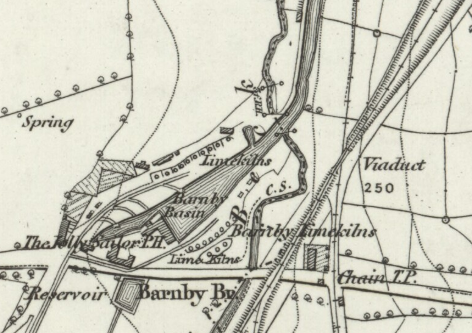
English: An extract from the 1850 Ordnance Survey map of Yorkshire (Number 274) showing Barnby Basin, the northern terminus of the Silkstone Waggonway |
| Date | |
| Source | https://maps.nls.uk/view/102345145 |
| Author | Ordnance Survey |
Licensing
|
This work is in the public domain in its country of origin and other countries and areas where the copyright term is the author's life plus 70 years or fewer. This work is in the public domain in the United States because it was published (or registered with the U.S. Copyright Office) before January 1, 1929. | |
| This file has been identified as being free of known restrictions under copyright law, including all related and neighboring rights. | |
File history
Click on a date/time to view the file as it appeared at that time.
| Date/Time | Thumbnail | Dimensions | User | Comment | |
|---|---|---|---|---|---|
| current | 04:11, 8 August 2019 | | 1,652 × 1,166 (2.38 MB) | The Mirror Cracked | User created page with UploadWizard |
File usage
The following pages on the English Wikipedia use this file (pages on other projects are not listed):