
File:Barentsz Full Map.jpg

Size of this preview: 800 × 594 pixels. Other resolutions: 320 × 237 pixels | 640 × 475 pixels | 1,000 × 742 pixels.
Original file (1,000 × 742 pixels, file size: 258 KB, MIME type: image/jpeg)
| This is a file from the Wikimedia Commons. Information from its description page there is shown below. Commons is a freely licensed media file repository. You can help. |
Summary
| Description |
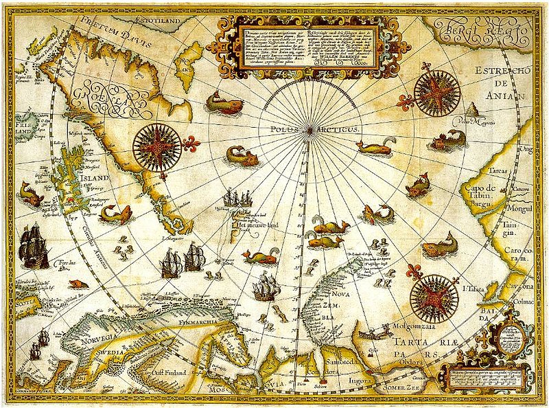
1598 map of the hree Arctic voyages (1594–1596) by Willem Barentsz. Delineatio cartae trium navigantium per Bataves, ad Septentrionalem plagam, Norvegiae, Moscoviae et novae Semblae Autore Wilhelmo Bernardo [1] [2] |
| Date | |
| Source | immediate source unknown, uploaded 2007 |
| Author | Willem Barentsz (Wilhelmus Bernardus) |
| Permission (Reusing this file) |
Public domain (over 70 years since creator's death) |
| Other versions |
|

.jpg)
_door_Willem_Barendsz_(titel_op_object),_NG-800.jpg)


Licensing
|
This work is in the public domain in its country of origin and other countries and areas where the copyright term is the author's life plus 100 years or fewer. | |
| This file has been identified as being free of known restrictions under copyright law, including all related and neighboring rights. | |
File history
Click on a date/time to view the file as it appeared at that time.
| Date/Time | Thumbnail | Dimensions | User | Comment | |
|---|---|---|---|---|---|
| current | 22:20, 5 December 2007 | | 1,000 × 742 (258 KB) | Sherurcij | {{Information |Description=Portion of 1599 map of Arctic exploration by Willem Barentsz. Spitsbergen, here mapped for the first time, is indicated as "Het Nieuwe Land" (Dutch for "the New Land"), center-left. |Source=[http://www.ub.uit.no/northernlights/e |
File usage
No pages on the English Wikipedia use this file (pages on other projects are not listed).
Global file usage
The following other wikis use this file:
- Usage on ar.wikipedia.org
- Usage on fr.wikipedia.org
- Usage on gcr.wikipedia.org
- Usage on kk.wikipedia.org
- Usage on nrm.wikipedia.org
- Usage on ru.wikipedia.org