
File:Bad Schallerbach - Rathaus.JPG

Size of this preview: 800 × 533 pixels. Other resolutions: 320 × 213 pixels | 640 × 427 pixels | 1,024 × 683 pixels | 1,280 × 853 pixels | 2,560 × 1,706 pixels | 4,441 × 2,960 pixels.
Original file (4,441 × 2,960 pixels, file size: 9.77 MB, MIME type: image/jpeg)
| This is a file from the Wikimedia Commons. Information from its description page there is shown below. Commons is a freely licensed media file repository. You can help. |
Summary
| Description |
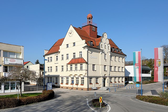
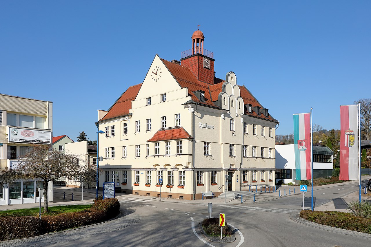
Deutsch: Das Rathaus am Rathausplatz in der oberösterreichischen Marktgemeinde Bad Schallerbach.
Das Rathaus wurde von 1923 bis 1924 von dem Architekten Mauriz Balzarek errichtet. Im Jahr 1918 stieß man im Ortsteil Schallerbach der Gemeinde Schönau bei der Erdölsuche auf Thermalwasser in 461,3 m Tiefe. 1921 gründeten das Land Oberösterreich und die Gemeinden Wallern und Schönau die Schwefelbad Schallerbach GesmbH. Am 3. Juni 1938 erfolgte die Namensänderung der Gemeinde Schönau in Gemeinde Bad Schallerbach. 2007 war Bad Schallerbach mit 734.000 Thermengästen die meistbesuchte Therme Österreichs. English: Town hall of Bad Schallerbach, Upper Austria.
|
| Date | |
| Source | Own work |
| Author | C.Stadler/Bwag |
| Permission (Reusing this file) |
Deutsch: Hallo, du darfst mein Foto kostenlos nutzen, aber nenne mich bitte als Fotograf, beispielsweise „Foto: C.Stadler/Bwag“ oder © C.Stadler/Bwag; CC-BY-SA-4.0. Auf mehr Angaben bestehe ich nicht - im Gegensatz zu manch anderen, die die Vorgaben der unten angeführten Lizenzierung auf Punkt und Beistrich einfordern. English: Feel free to use my photos, but please mention me as the author like © C.Stadler/Bwag or © C.Stadler/Bwag; CC-BY-SA-4.0 (that's good enough) and if you want send me a message: bwag@gmx.net. |
| Object location | | View this and other nearby images on: OpenStreetMap |
|---|
| Camera location | | View this and other nearby images on: OpenStreetMap |
|---|
Licensing
I, the copyright holder of this work, hereby publish it under the following license:
This file is licensed under the Creative Commons Attribution-Share Alike 4.0 International license.
- You are free:
- to share – to copy, distribute and transmit the work
- to remix – to adapt the work
- Under the following conditions:
- attribution – You must give appropriate credit, provide a link to the license, and indicate if changes were made. You may do so in any reasonable manner, but not in any way that suggests the licensor endorses you or your use.
- share alike – If you remix, transform, or build upon the material, you must distribute your contributions under the same or compatible license as the original.
File history
Click on a date/time to view the file as it appeared at that time.
| Date/Time | Thumbnail | Dimensions | User | Comment | |
|---|---|---|---|---|---|
| current | 20:58, 10 November 2020 | | 4,441 × 2,960 (9.77 MB) | Bwag | {{Information |Description= {{de|1= Das Rathaus von der oberösterreichischen Gemeinde Bad Schallerbach.<br/>Das Rathaus wurde von 1923–1924 von dem Architekten Mauriz Balzarek errichtet. Im Jahr 1918 stieß man im Ortsteil Schallerbach der Gemeinde Schönau bei der Erdölsuche auf Thermalwasser in 461,3 m Tiefe. 1921 gründeten das Land Oberösterreich und die Gemeinden Wallern und Schönau die Schwefelbad Schallerbach GesmbH. Am 3. Juni 1938 erfolgte die Namensänderung der ''Gemeinde Schönau'' in... |
File usage
The following pages on the English Wikipedia use this file (pages on other projects are not listed):
Global file usage
The following other wikis use this file:
- Usage on de.wikipedia.org
- Usage on nl.wikipedia.org
- Usage on www.wikidata.org