
File:Awaji-island 1.png
Size of this preview: 544 × 599 pixels. Other resolutions: 218 × 240 pixels | 436 × 480 pixels | 903 × 995 pixels.
Original file (903 × 995 pixels, file size: 372 KB, MIME type: image/png)
| This is a file from the Wikimedia Commons. Information from its description page there is shown below. Commons is a freely licensed media file repository. You can help. |
Summary
| Description |
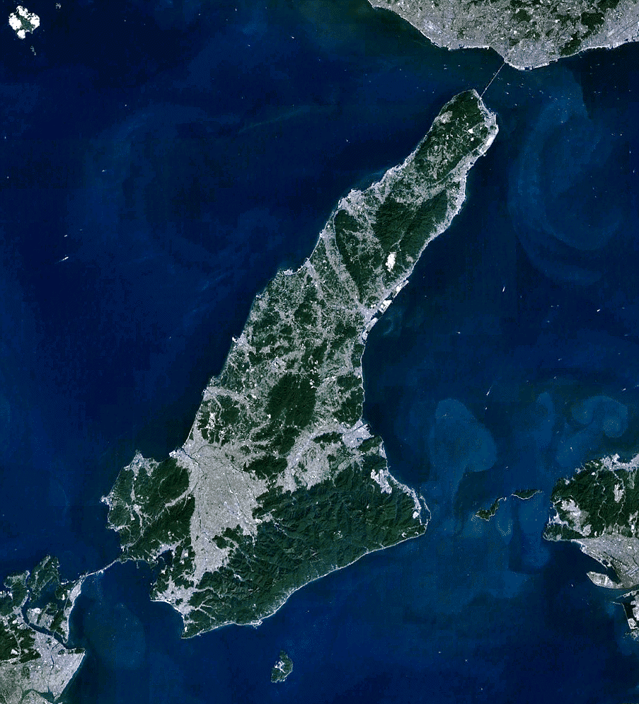
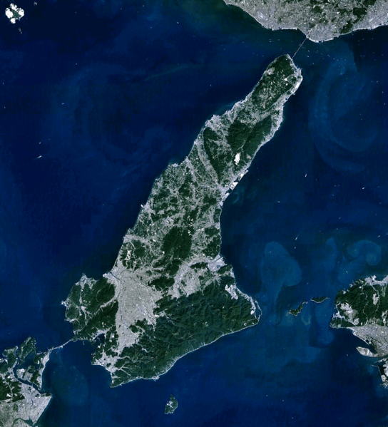
English: the view of Awaji-shima(island), from Landsat, generated on NASA World Wind.
日本語: 衛星ランドサットからの淡路島。NASA World Windで作成。 |
| Date | |
| Source | NASA World Wind (http://worldwind.arc.nasa.gov/java/ ) |
| Author | Pinqui |
| Other versions |
|

Licensing
| This image is in the public domain because it is a screenshot from NASA’s globe software World Wind using a public domain layer, such as Blue Marble, MODIS, Landsat, SRTM, USGS or GLOBE.
|
 |
File history
Click on a date/time to view the file as it appeared at that time.
| Date/Time | Thumbnail | Dimensions | User | Comment | |
|---|---|---|---|---|---|
| current | 01:28, 8 December 2010 | | 903 × 995 (372 KB) | Pinqui | {{Information |Description={{en|1=the view of Awaji-shima(island), from Landsat, generated on NASA World Wind.}} {{ja|1=衛星ランドサットからの淡路島。NASA World Windで作成。}} |Source=NASA World Wind (http://worldwind.arc.nasa.gov/java/ |
File usage
The following pages on the English Wikipedia use this file (pages on other projects are not listed):
Global file usage
The following other wikis use this file:
- Usage on ar.wikipedia.org
- Usage on ca.wikipedia.org
- Usage on ceb.wikipedia.org
- Usage on cs.wikipedia.org
- Usage on de.wikipedia.org
- Usage on en.wikivoyage.org
- Usage on es.wikipedia.org
- Usage on fi.wikipedia.org
- Usage on fr.wikivoyage.org
- Usage on he.wikipedia.org
- Usage on he.wikivoyage.org
- Usage on hy.wikipedia.org
- Usage on incubator.wikimedia.org
- Usage on ja.wikipedia.org
- Usage on ko.wikipedia.org
- Usage on nl.wikipedia.org
- Usage on ro.wikipedia.org
- Usage on sl.wikipedia.org
- Usage on th.wikipedia.org
- Usage on uk.wikipedia.org
- Usage on www.wikidata.org