
File:Australia South Australia location map.svg

Original file (SVG file, nominally 1,535 × 1,783 pixels, file size: 367 KB)
| This is a file from the Wikimedia Commons. Information from its description page there is shown below. Commons is a freely licensed media file repository. You can help. |
Summary
| Description |
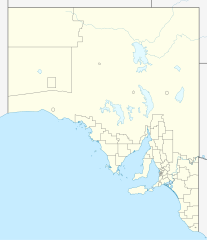
Quadratische Plattkarte, N-S-Streckung 117 %. Geographische Begrenzung der Karte:
Equirectangular projection, N/S stretching 117 %. Geographic limits of the map:
|
|
| Date | ||
| Source |
Own work, using
|
|
| Author | NordNordWest | |
| Permission (Reusing this file) |
This file is licensed under the Creative Commons Attribution-Share Alike 3.0 Germany license.
 This file is licensed under the Creative Commons Attribution-Share Alike 3.0 Germany license.
|


|
This map has been made or improved in the German Kartenwerkstatt (Map Lab). You can propose maps to improve as well.
|
File history
Click on a date/time to view the file as it appeared at that time.
| Date/Time | Thumbnail | Dimensions | User | Comment | |
|---|---|---|---|---|---|
| current | 22:08, 4 April 2010 | | 1,535 × 1,783 (367 KB) | Chumwa | Reverted to version as of 20:05, 29 December 2009 |
| 21:54, 4 April 2010 |  | 1,535 × 1,783 (316 KB) | Roke~commonswiki | local government low salience, dont appear on general use maps | |
| 20:05, 29 December 2009 |  | 1,535 × 1,783 (367 KB) | NordNordWest | =={{int:filedesc}}== {{Information |Description= {{de|Positionskarte von South Australia, Australien}} Quadratische Plattkarte, N-S-Streckung 117 %. Geographische Begrenzung der Karte: * N: 25.6° S * S: 38.5° S |
File usage
More than 100 pages use this file. The following list shows the first 100 pages that use this file only. A full list is available.
- Acraman impact structure
- Adelaide Airport
- Adelaide Gaol
- Alberton, South Australia
- Anna Creek Station
- Arkaroola
- Balhannah
- Barossa Valley
- Barossa Valley Way
- Berri, South Australia
- Birdwood, South Australia
- Burra, South Australia
- Cape Jervis
- Ceduna, South Australia
- Chadinga Conservation Park
- Colonel Light Gardens, South Australia
- Coober Pedy
- Cook, South Australia
- Copley, South Australia
- Crawford crater
- Crystal Brook, South Australia
- Cudlee Creek
- Cummins, South Australia
- District Council of Alexandrina
- District Council of Wakefield Plains
- Dublin, South Australia
- Dukes Highway
- Elizabeth, South Australia
- Emu Field, South Australia
- Eyre Peninsula
- Farina, South Australia
- Flaxman crater
- Fleurieu Peninsula
- Flinders Highway, South Australia
- Gladstone, South Australia
- Glenelg, South Australia
- Glossop, South Australia
- Goodwood, South Australia
- Goolwa, South Australia
- Granite Island (South Australia)
- Hacks Lagoon Conservation Park
- Hahndorf, South Australia
- Hawker, South Australia
- Hindmarsh Island
- Kapunda
- Karoonda, South Australia
- Keith, South Australia
- Kingston SE
- Kuitpo Forest
- Leigh Creek, South Australia
- Limestone Coast
- Lincoln Highway, South Australia
- Marree, South Australia
- Melrose, South Australia
- Monash, South Australia
- Morgan, South Australia
- Mount Barker, South Australia
- Mount Gambier
- Mount Toondina crater
- Murray Bridge, South Australia
- Naracoorte, South Australia
- Neptune Islands
- Nuriootpa, South Australia
- Oodnadatta
- Oodnadatta Track
- Osborne, South Australia
- Padthaway, South Australia
- Peterborough, South Australia
- Port Adelaide
- Port Augusta
- Port Augusta Prison
- Port Broughton, South Australia
- Port Elliot, South Australia
- Port Lincoln
- Port Lincoln Prison
- Port Pirie
- Port Wakefield Highway
- Quorn, South Australia
- Renmark, South Australia
- Riddoch Highway
- Robe, South Australia
- Roseworthy, South Australia
- Sheidow Park, South Australia
- Snowtown, South Australia
- South Eastern Freeway
- Tailem Bend, South Australia
- Tanunda, South Australia
- Tea Tree Gully, South Australia
- Teringie, South Australia
- Terowie, South Australia
- Thevenard, South Australia
- Tod Highway
- Torrens Park, South Australia
- Truro, South Australia
- Uraidla, South Australia
- Victor Harbor, South Australia
- Wallaroo, South Australia
- Waterfall Gully, South Australia
- Wellington, South Australia
- Whyalla
View more links to this file.
Global file usage
The following other wikis use this file:
- Usage on af.wikipedia.org
- Usage on ar.wikipedia.org
- Usage on ast.wikipedia.org
- Usage on azb.wikipedia.org
- Usage on ba.wikipedia.org
- Usage on be.wikipedia.org
- Usage on bg.wikipedia.org
- Usage on ceb.wikipedia.org
- Usage on de.wikipedia.org
- Adelaide
- Coober Pedy
- Klemzig
- Woomera (Australien)
- Riverland
- Goodwood (South Australia)
- Keith (Australien)
- Hahndorf (South Australia)
- Waterfall Gully
- Maralinga
- Renmark
- Naracoorte
- William Creek
- Aldgate (South Australia)
- Mount Gambier
- Murray Bridge
- Port Augusta
- Port Pirie
- Port Lincoln
- Victor Harbor
- Whyalla
- Anna Creek Station
- Tarcoola
- Melrose (South Australia)
- Cook (South Australia)
- Vorlage:Positionskarte Australien Südaustralien
- Lobethal
- Ooldea
- Flughafen Port Augusta
- Flugplatz Coober Pedy
- Angaston
- Mungeranie
- Wikipedia:Kartenwerkstatt/Positionskarten/Australien und Ozeanien
- Burra (Australien)
View more global usage of this file.