
File:Aukside Farm geograph-1799865-by-Les-Hull.jpg
No higher resolution available.
Aukside_Farm_geograph-1799865-by-Les-Hull.jpg (600 × 450 pixels, file size: 354 KB, MIME type: image/jpeg)
| This is a file from the Wikimedia Commons. Information from its description page there is shown below. Commons is a freely licensed media file repository. You can help. |
Summary
| Description |
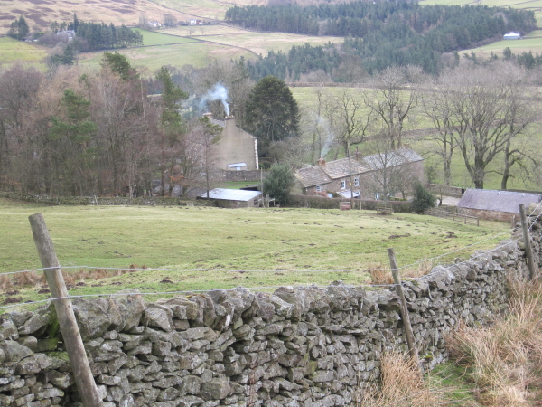
English: Aukside Farm. There are a cluster of residential buildings at Aukside and I can't imagine them all being used for farming, A lead mine was near by so I assume some may have been built to accommodate the lead miners. Some farmers also worked the mines to generate extra income. |
| Date | |
| Source | From geograph.org.uk |
| Author | Les Hull |
| Permission (Reusing this file) |
Creative Commons Attribution Share-alike license 2.0 |
| Attribution (required by the license) | Les Hull / Aukside Farm / |
| Camera location | | View this and other nearby images on: OpenStreetMap |
|---|
_heading:45.00&language=en)
| Object location | | View this and other nearby images on: OpenStreetMap |
|---|
_heading:45.00&language=en)
Licensing

|
This image was taken from the Geograph project collection. See this photograph's page on the Geograph website for the photographer's contact details. The copyright on this image is owned by Les Hull and is licensed for reuse under the Creative Commons Attribution-ShareAlike 2.0 license.
|
This file is licensed under the Creative Commons Attribution-Share Alike 2.0 Generic license.
Attribution: Les Hull
- You are free:
- to share – to copy, distribute and transmit the work
- to remix – to adapt the work
- Under the following conditions:
- attribution – You must give appropriate credit, provide a link to the license, and indicate if changes were made. You may do so in any reasonable manner, but not in any way that suggests the licensor endorses you or your use.
- share alike – If you remix, transform, or build upon the material, you must distribute your contributions under the same or compatible license as the original.
File history
Click on a date/time to view the file as it appeared at that time.
| Date/Time | Thumbnail | Dimensions | User | Comment | |
|---|---|---|---|---|---|
| current | 13:33, 6 April 2021 | | 600 × 450 (354 KB) | Storye book | == {{int:filedesc}} == {{Information |Description={{en|1=Aukside Farm. There are a cluster of residential buildings at Aukside and I can't imagine them all being used for farming, A lead mine was near by so I assume some may have been built to accommodate the lead miners. Some farmers also worked the mines to generate extra income.}} |Source=From [https://www.geograph.org.uk/photo/1799865 geograph.org.uk] |Date=2010-04-04 |Author=[https://www.geograph.org.uk/profile/3612 Les Hull] |Permission... |
File usage
The following pages on the English Wikipedia use this file (pages on other projects are not listed):
Global file usage
The following other wikis use this file: