
File:Asturias location map.svg

Size of this PNG preview of this SVG file: 512 × 378 pixels. Other resolutions: 320 × 236 pixels | 640 × 473 pixels | 1,024 × 756 pixels | 1,280 × 945 pixels | 2,560 × 1,890 pixels.
Original file (SVG file, nominally 512 × 378 pixels, file size: 158 KB)
| This is a file from the Wikimedia Commons. Information from its description page there is shown below. Commons is a freely licensed media file repository. You can help. |
| Description |
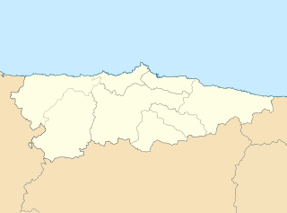
English: Location map of Asturias Equirectangular projection, N/S stretching 130 %. Geographic limits of the map: * N: 44.141° N * S: 42.498° N * W: 7.286° O * E: 4.375° O Español: Mapa de localización de Asturias Proyección equirrectangular, N/S estirada 130 %. Límites geográficos del mapa: * N: 44.141° N * S: 42.498° N * W: 7.286° O * E: 4.375° O |
| Date | (UTC) |
| Source | |
| Author |
|
| Other versions | Derivative works of this file: Circunscripciones electorales Asturias.svg |
| This is a retouched picture, which means that it has been digitally altered from its original version. Modifications: harmonisation des couleurs. The original can be viewed here: Asturias-loc.svg:
|
I, the copyright holder of this work, hereby publish it under the following license:
This file is licensed under the Creative Commons Attribution-Share Alike 3.0 Unported license.
- You are free:
- to share – to copy, distribute and transmit the work
- to remix – to adapt the work
- Under the following conditions:
- attribution – You must give appropriate credit, provide a link to the license, and indicate if changes were made. You may do so in any reasonable manner, but not in any way that suggests the licensor endorses you or your use.
- share alike – If you remix, transform, or build upon the material, you must distribute your contributions under the same or compatible license as the original.
Original upload log
This image is a derivative work of the following images:
- File:Asturias-loc.svg licensed with Cc-by-sa-3.0
- 2010-05-07T11:44:07Z Miguillen 512x378 (272467 Bytes) {{Information |Description=Mapa delocalización del Principado de Asturias |Source={{own}} |Date=2009-05-07 |Author=[[User:Miguillen|Miguillen]] |Permission= |other_versions= }} [[Category:Maps of Asturias]]
Uploaded with derivativeFX
File history
Click on a date/time to view the file as it appeared at that time.
| Date/Time | Thumbnail | Dimensions | User | Comment | |
|---|---|---|---|---|---|
| current | 11:07, 19 May 2010 | | 512 × 378 (158 KB) | Miguillen | borde de costa |
| 09:49, 18 May 2010 |  | 512 × 378 (144 KB) | Xfigpower | {{Information |Description={{en|Location map of Asturias}} Equirectangular projection, N/S stretching 130 %. Geographic limits of the map: * N: 44.141° N * S: 42.498° N * W: 7.286° O * E: 4.375° O {{es|Mapa de localización de [ |
File usage
The following pages on the English Wikipedia use this file (pages on other projects are not listed):
- 1992 Summer Olympics torch relay
- 2013–14 Tercera División
- 2014–15 Tercera División
- 2015–16 Tercera División
- 2016–17 Tercera División
- 2017–18 Tercera División
- 2018–19 Tercera División
- 2019–20 Tercera División
- 2020–21 Segunda División B
- 2020–21 Tercera División
- 2021–22 Tercera División RFEF
- 2022–23 Tercera Federación
- 2023–24 Tercera Federación
- Alfilorios Reservoir
- Asturian derby
- Asturias Airport
- Castiello Bernueces
- Castrillón
- Colloto
- Divisiones Regionales de Fútbol in Asturias
- Ethnographic Museum of Grandas de Salime
- Grado (parish)
- Juan Barjola Museum of Painting
- Las Caldas cave
- Lastres Formation
- Llameiru
- Lugones, Siero
- Museo del Calamar Gigante
- Museum of the Siderurgy
- Noreña
- Perlavia
- Primera División de Baloncesto
- Puerto de Vega
- Ribadedeva
- Salime Reservoir
- San Andrés de Agues
- San Andrés de los Tacones Reservoir
- San Antolín de Bedón (Llanes)
- San Tiso
- Santiagu'l Monte
- Sidrón Cave
- Tereñes Formation
- Tinéu
- Tito Bustillo Cave
- Trasona Reservoir
- Trelles
- Vega Formation
- Villaviciosa, Asturias
- User:Michael!/Project:Location map templates/Spain
- Module:Location map/data/Spain Asturias
- Module:Location map/data/Spain Asturias/doc
Global file usage
The following other wikis use this file:
- Usage on ast.wikipedia.org
- Xixón
- Castiello Bernueces (parroquia)
- Valdornón
- Cabueñes
- Caldones (parroquia)
- L'Abadía Cenero
- Deva (parroquia)
- Fano (parroquia)
- Fresno (parroquia)
- Granda (Xixón)
- Samartín de Güerces
- Llavandera (parroquia)
- Llorio
- La Pedrera (parroquia)
- Porceyo
- Puao
- Roces (Xixón)
- Ruedes (parroquia)
- Santurio
- Serín
- Somió
- San Andrés de los Tacones
- Vega (Xixón)
- Veriña
- Xove
- Naves (parroquia de Llanes)
- Cecos
- Santolaya de Vixil
- Zardaín
- Navelgas
- Santolaya de Miñu
- La Puela (parroquia)
- Caborana (parroquia)
- Uxo
- Celoriu (Llanes)
- Universidá d'Uviéu
- Ríu Nalón
- Blimea (parroquia)
- Santa Bárbola
- Bisuyu (Allande)
- Bustantigo (parroquia)
- San Andrés (Trubia)
- Lliberdón (parroquia)
- Cuadonga
- Llastres (parroquia)
- Berducedo (parroquia)
- Llago (parroquia)
- Ḷḷinares (parroquia d'Allande)
- Ḷḷomes (parroquia)
- Paraxes (parroquia)
View more global usage of this file.