
File:Asia Minor Map, Classical Atlas, 1886, Keith Johnston.jpg

Original file (3,669 × 2,824 pixels, file size: 917 KB, MIME type: image/jpeg)
| This is a file from the Wikimedia Commons. Information from its description page there is shown below. Commons is a freely licensed media file repository. You can help. |
Summary
| Description |
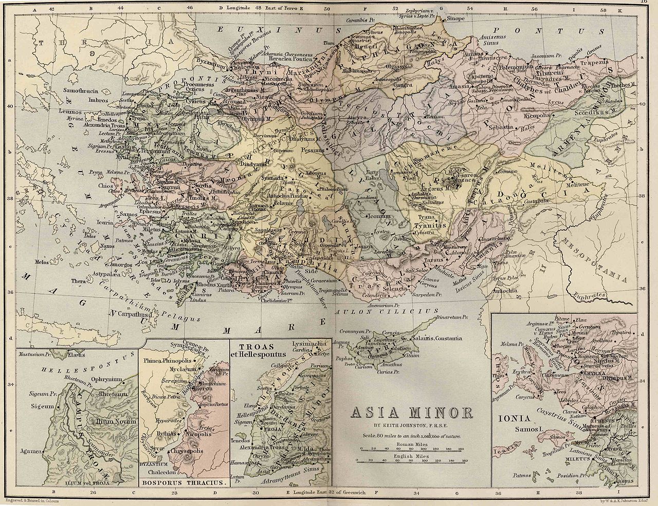
English: Asia Minor. Including Pontus, Cappadocia, Cilicia, Pisidia, Lycia, Caria, Lydia, Mysia, Bithynia, Paphlagonia, Phrygia, and Crete.
"These color maps are 11" x 13.5" when printed at 300dpi. They were copied from an original 1886 Ginn & Company Classical Atlas designed by mapmaker Keith Johnston. These maps are completely Public Domain and can be used absolutely without restriction or even sold commercially without my permission. (There is slight distortion caused by the age of the original and merging the scans (two scans per map)" Information from http://www.snible.org/greek/ |
|||||||||||||||||||
| Date | ||||||||||||||||||||
| Source | Ginn & Company Classical Atlas | |||||||||||||||||||
| Author |
|
|||||||||||||||||||
| Other versions | Derivative works of this file: Location of Isauria-Asia Minor Map, Classical Atlas, 1886, Keith Johnston.jpg | |||||||||||||||||||
Licensing
|
This work is in the public domain in its country of origin and other countries and areas where the copyright term is the author's life plus 100 years or fewer. | |
| This file has been identified as being free of known restrictions under copyright law, including all related and neighboring rights. | |
File history
Click on a date/time to view the file as it appeared at that time.
| Date/Time | Thumbnail | Dimensions | User | Comment | |
|---|---|---|---|---|---|
| current | 21:05, 3 December 2009 | | 3,669 × 2,824 (917 KB) | Jssfrk | {{Information |Description={{en|1=Asia Minor. Including Pontus, Cappadocia, Cilicia, Pisidia, Lycia, Caria, Lydia, Mysia, Bithynia, Paphlagonia, Phrygia, and Crete. "These color maps are 11" x 13.5" when printed at 300dpi. They were copied from an origin |
File usage
Global file usage
The following other wikis use this file:
- Usage on az.wikipedia.org
- Usage on cs.wikipedia.org
- Usage on pl.wikipedia.org
- Usage on ru.wikipedia.org
- Usage on tr.wikipedia.org