
File:Arthog Afon Mawddach valley geograph-3237427-by-Ben-Brooksbank.jpg
Size of this preview: 800 × 486 pixels. Other resolutions: 320 × 194 pixels | 640 × 389 pixels | 1,024 × 622 pixels | 1,280 × 777 pixels | 2,395 × 1,454 pixels.
Original file (2,395 × 1,454 pixels, file size: 2.87 MB, MIME type: image/jpeg)
| This is a file from the Wikimedia Commons. Information from its description page there is shown below. Commons is a freely licensed media file repository. You can help. |
Summary
| Description |
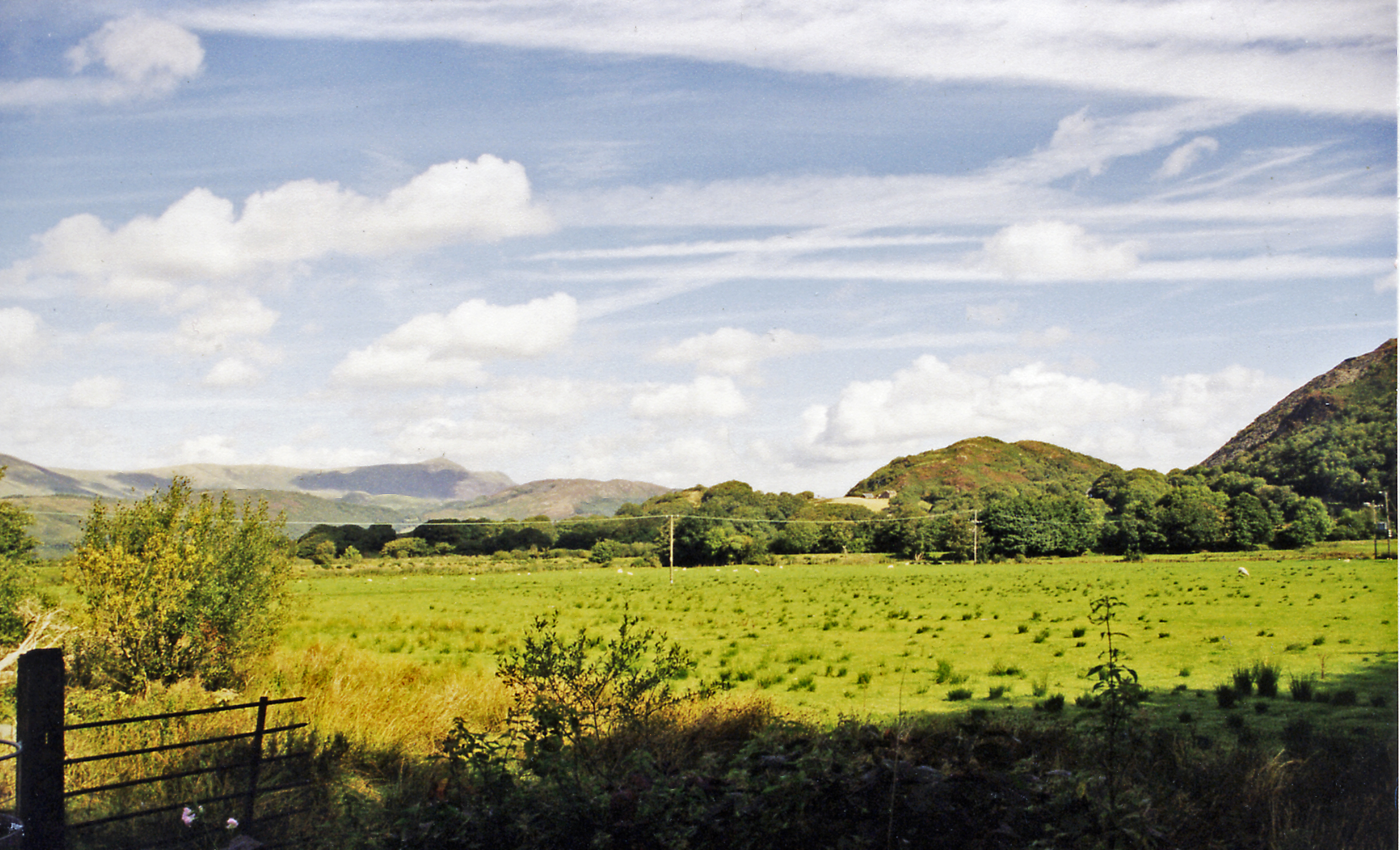
English: NE view up Afon Mawddach valley from A494 towards site of Arthog station. The ex-Cambrian Railway station had been in the middle distance running along the south side of the river between Morfa Mawddach (left, former Barmouth Junction) to Dolgellau (right), thence ex-GWR to Bala Junction, Llangollen and Ruabon - (Wrexham - Chester). The station closed with the line on 18/1/65. Up to the right are the lower slopes of Cader Idris (2,927 ft.), next is Bryn Brith (1,256 ft.) and in the distance is Y-Garn (2,064 ft.). |
| Date | |
| Source | From geograph.org.uk |
| Author | Ben Brooksbank |
| Permission (Reusing this file) |
Creative Commons Attribution Share-alike license 2.0 |
| Attribution (required by the license) | Ben Brooksbank / NE view up Afon Mawddach valley from A494 towards site of Arthog station / |
| Camera location | | View this and other nearby images on: OpenStreetMap |
|---|
Licensing

|
This image was taken from the Geograph project collection. See this photograph's page on the Geograph website for the photographer's contact details. The copyright on this image is owned by Ben Brooksbank and is licensed for reuse under the Creative Commons Attribution-ShareAlike 2.0 license.
|
This file is licensed under the Creative Commons Attribution-Share Alike 2.0 Generic license.
Attribution: Ben Brooksbank
- You are free:
- to share – to copy, distribute and transmit the work
- to remix – to adapt the work
- Under the following conditions:
- attribution – You must give appropriate credit, provide a link to the license, and indicate if changes were made. You may do so in any reasonable manner, but not in any way that suggests the licensor endorses you or your use.
- share alike – If you remix, transform, or build upon the material, you must distribute your contributions under the same or compatible license as the original.
File history
Click on a date/time to view the file as it appeared at that time.
| Date/Time | Thumbnail | Dimensions | User | Comment | |
|---|---|---|---|---|---|
| current | 20:48, 17 December 2012 | | 2,395 × 1,454 (2.87 MB) | Chevin | == {{int:filedesc}} == {{Information |Description={{en|1='''NE view up Afon Mawddach valley from A494 towards site of Arthog station.'''<br/> The ex-Cambrian Railway station had been in the middle distance running along the south side of the river betw... |
File usage
The following pages on the English Wikipedia use this file (pages on other projects are not listed):
Global file usage
The following other wikis use this file:
- Usage on www.wikidata.org